

For more than forty years now, my family has vacationed in a small cabin in the Blue Ridge Mountains of North Carolina, near the tiny village of Laurel Springs. We built the cabin in the early 1970s, though we began visiting the area long before that. My father first came with my mother and sister in the mid-1950s, when he was in medical school in Winston-Salem. On Saturday mornings, they would drive up to Doughton Park, a large recreation area on the Blue Ridge Parkway, eat lunch at the Park’s coffee shop, hike in the woods and meadows nearby, and sometimes spend the night in the Park’s rustic lodge.

After my father joined a medical practice in Raleigh in 1964, the trips became longer and more frequent. Now with three young boys, my parents must have appreciated not only the beauty and tranquility of the place but also the wild spaces for their children to roam and play in. I have vivid memories of hiking in Doughton Park’s woods, running in the Park’s famous high meadows, eating ham biscuits at the Park’s coffee shop, and sitting by the lodge’s outdoor fireplace on starlit summer nights. We sometimes camped in the Park’s campground, and we often took day trips further up and down the Parkway.

In the early 1970s, my father asked a waitress at the Doughton Park coffee shop about local real estate, and before long he had bought a twelve-acre parcel of land off a country road near Laurel Springs. There, we built a cabin of my father’s own design. It’s a small structure but has served us well – on the first floor, there’s a large room with high ceilings and a fireplace, combining kitchen, dining room, and living room, and, off to the side, two small bedrooms. Upstairs there are two more small bedrooms. The land is half rolling meadow, half wooded hillside. The gravel driveway we built, through the meadow, is now lined with tall pine trees, and the hillside above is now forested so thickly it’s impossible to walk to the top.


Growing up, I loved that cabin and the land around it. I explored every inch of the property and even drew a map of it, giving names to the footpaths that crossed the hillside and the little creek that tumbled down through the mountain laurel. I explored further afield as well: hiking along the country road at the bottom of our hill and the cow pastures, trout streams, and dense forests that bordered it. But it was Doughton Park, with its high meadows, steep bluffs, and rugged valleys, that I loved more than anything. It was only a few miles from the cabin, and we often went every day when we were there.  We would sometimes drive up to the coffee shop in the morning for breakfast, return in the afternoon for a hike, and later take an evening drive to look for deer. We would even go up in the winter, when no one else was around.
Originally called The Bluffs, 6,000 acre Doughton Park was created in the 1930s when the Blue Ridge Parkway was routed through this part of North Carolina. It was one of the first parts of the Parkway to be completed and remains its largest recreation area. In the 1950s, it was renamed for Robert Lee Doughton (1863-1954), a local landowner and politician, who was instrumental in getting the Parkway built. Mr. Doughton (pronounced “dow-ton”) was born, lived, and died in Laurel Springs; his house stands to this day across from the Laurel Springs post office, and his grave is in the cemetery at Laurel Springs Baptist Church. He was a U.S. congressman from 1911 to 1953 and chairman of the House Ways and Means Committee for most of the period from 1933 to 1953. A fiscal conservative, he nonetheless admired his fellow Democrat Franklin D. Roosevelt, and he generally supported the New Deal, which included the building of the Blue Ridge Parkway through his home district.
-

- Historical marker, Laurel Springs
-

- R. L. Doughton House, Laurel Springs
-
- Memorial in Doughton Park
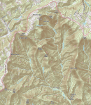
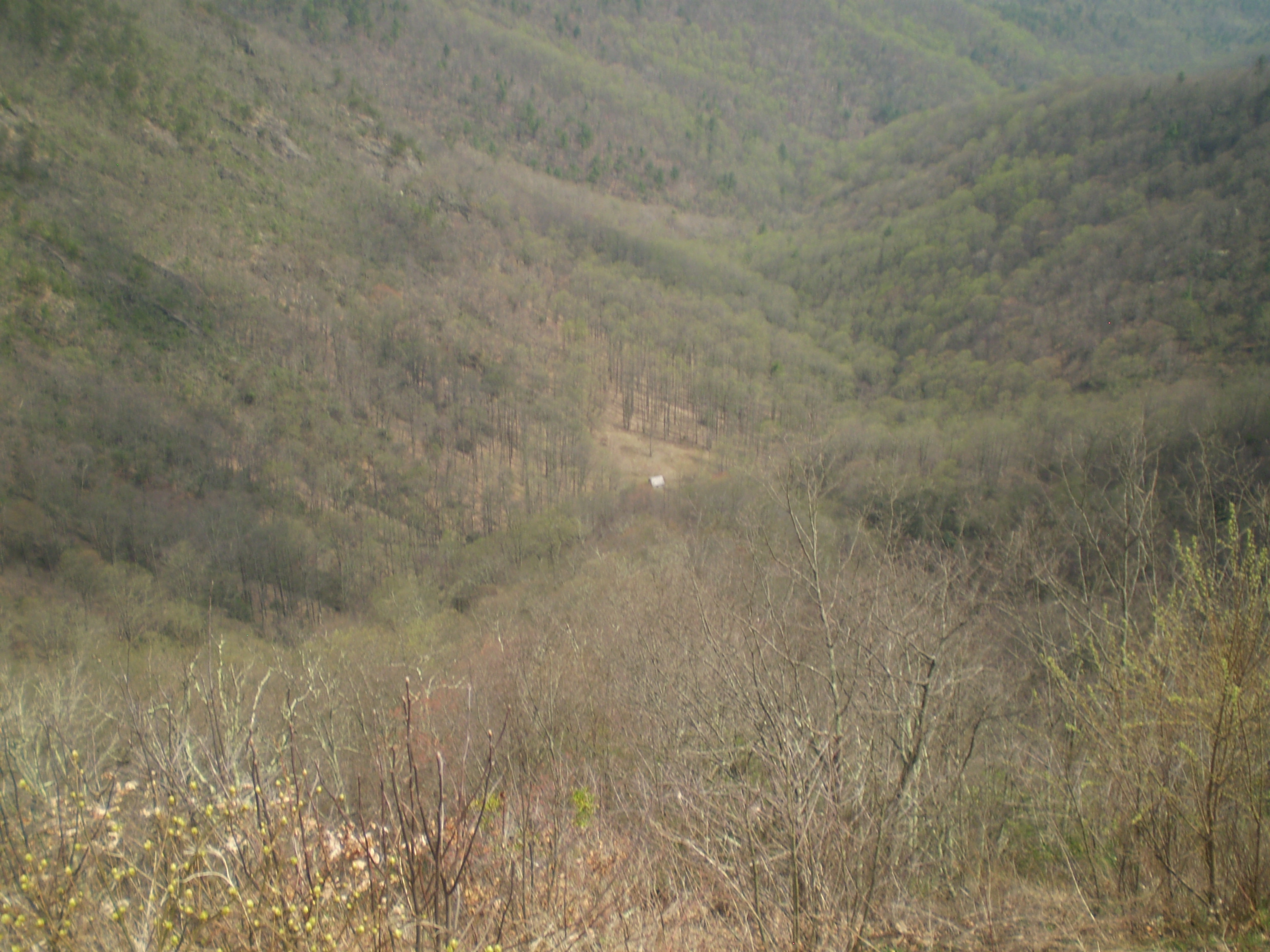
The northern and western borders of Doughton Park are formed by the Parkway itself, which here follows the crest of the mountains, traveling at more than 3,000 feet above sea level through rolling highland meadow. The other borders of the Park are traced by steeply descending mountain ridges: Flat Rock Ridge along the southern side of the Park and Cedar Ridge along the eastern side. Within these borders is the rugged and remote watershed of two mountain streams, Basin Creek and Cove Creek. Together, the double valley – or double gorge – is known as Basin Cove.
-
- USGS, Whitehead Quadrangle, NC (2013)
-

- USGS, Whitehead Quadrangle, NC (2013)
The area is wilderness now, but in the late nineteenth and early twentieth centuries, pioneer families lived here in small cabins along the creeks, with plots of cleared land for farming and footpaths connecting them to one another and the world outside. Looking up, the settlers could see the sheer cliffs, rock faces, and steep sides of Bluff Mountain and its neighbors. Today, Doughton Park is a combination not only of uninhabited wilderness and landscaped recreation areas, but of gently rolling meadows, steep forested hillside, and dense creek valleys.

There are about 30 miles of hiking trails in Doughton Park. Growing up, I knew them all. The longest are the four trails that descend into Basin Cove: the wide Grassy Gap Fire Road is both the longest and most gently descending; the Flat Rock Ridge, Cedar Ridge, and Bluff Ridge Trails are steeper and more strenuous, though they get you down to the valley floor faster. (A good strategy is to go down one of the ridge trails and then return via Grassy Gap.) Some of the fondest memories of my childhood are hiking those trails with my family. We would leave early, taking lunch, water, and our dog Maggie, who would often disappear for hours at a stretch – we would hear her barking a mile away and worry that she was lost or had encountered an animal bigger than she was. But she always eventually found us, probably because we made so much noise ourselves, clapping and whatnot – a ranger had told my father that was the way to ward off rattlesnakes.
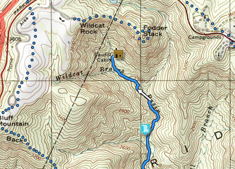
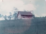
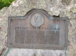
Once you’re in Basin Cove, you can hike up the Basin Creek Trail to the foot of Bluff Mountain, where you’ll find, in a small clearing by the creek, the most famous attraction in Doughton Park: the Caudill Cabin, an abandoned log house, 16 by 18 feet in size, on stone piers, with a wood-shingled roof and stone chimney. It was built by Martin Caudill in 1890 for his large and growing family. Located high up Basin Cove, the cabin is about 1,500 feet directly below Wildcat Rocks, where it is visible to Parkway travelers from a dramatic overlook near the lodge. For nearly seventy-five years, a sign at Wildcat Rocks has told visitors about the Caudill Cabin, its occupants, and pioneer life in Basin Cove. (Another, even-better preserved pioneer cabin in Doughton Park is the Brinegar Cabin, built in 1886 and now on the National Register of Historic Places; it’s right on the Parkway itself, at milepost 238.)
-

- Wildcat Rocks, Doughton Park
-

- The view from Wildcat Rocks
-

- Caudill Cabin, Doughton Park
(Most of the color photographs in this post are my own; the black-and-white photographs, unless otherwise indicated, are from either “Driving Through Time: The Digital Blue Ridge Parkway” or the Historic American Engineering Record [HAER] at the Library of Congress – see “Works Cited” for links.)
Downstream from Martin Caudill’s cabin was the cabin of Harrison Caudill, his father; and other families lived nearby. A flood in 1916 killed several residents and destroyed most of the man-made structures here; the Caudill Cabin survived, but the family abandoned the area soon after, and the Cove was never again a significant human settlement. In 1938, as the Blue Ridge Parkway was being built and Bluffs Park assembled, the National Park Service purchased the Caudill Cabin; it has been a popular exhibit at the Park ever since, even if most visitors only see it from the cliffs above. The cabin has been a part of my life for as long as I can remember. In the 1950s, my father would try, often unsuccessfully, to point it out to my sister when she was little; later, in the early 1970s, we hiked down to it for the first time; and it remains a highlight of Doughton Park for family and friends who visit us.
The video below shows author Randy Johnson hiking up Basin Creek to visit the cabin with three descendants of Martin Caudill.
Besides the trails in Basin Cove, Doughton Park also contains a lovely walk that parallels the Parkway itself, known as the Bluff Mountain Trail. And, then there’s the Fodderstack Trail, which departs from the parking lot at Wildcat Rocks and follows a mountain ridge due east, forming a loop at the end before returning. This has always been a favorite hike of my family. It’s only about two miles long, round trip, but it includes diverse terrain and beautiful views of Basin Cove. (When I was younger, there was a steep path that descended straight to the Caudill Cabin from the end of Fodderstack, but it doesn’t appear on official maps of the Park today.)
-

- The meadows, Doughton Park
-

- Rolling grasslands, Bluff Mountain, 1930s
-

- The meadows, Doughton Park
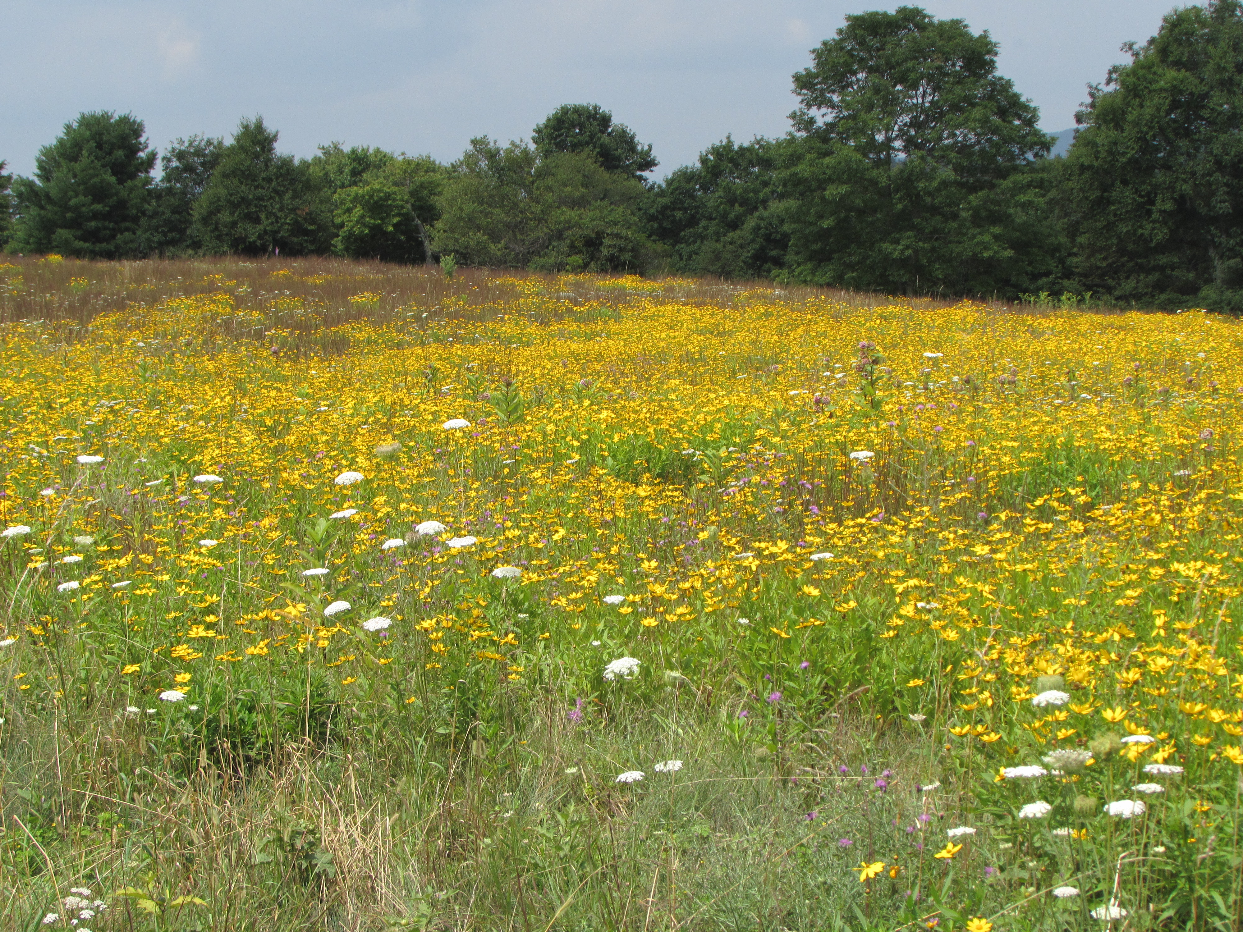
As my siblings and I have aged, we walk more and more in the meadows behind the lodge – where we ran as children. The terrain there is hilly but not too strenuous and affords good views not only of Doughton Park’s grassy highlands but of the distant Blue Ridge mountains, which roll out to the southwest as far as the eye can see. We always end up at Alligator Back, another sheer face of Bluff Mountain, with its spectacular views of both Basin Cove and the Parkway itself. In a 1961 guidebook to this part of the Blue Ridge Parkway, which I read as a boy, author William Lord says of Alligator Back that “the view about you is a wonderful hurly-burly of hills.”
For the past twenty-five years, I have lived far from North Carolina – in Texas, Pennsylvania, New Mexico, Wisconsin, and Massachusetts. For most of that time, when I was able to come back with my children, we stayed mostly in Raleigh, where my parents live. If we could stay longer – in the summers, for example – it was the beaches of North Carolina that tempted us. I think I once went five years without setting foot in the cabin.

Blue Ridge Parkway, Doughton Park, milepost 244
But as my parents aged, my children grew up, and my career made somewhat fewer demands on me, I found myself coming more frequently to North Carolina and plotting more determinedly to be in the mountains. Last summer, I drove down from Massachusetts and spent two weeks at the cabin by myself. I wrote in the mornings and rode my bike on the Parkway in the afternoons. Occasionally, I would drive into Sparta, the Alleghany County seat, to buy groceries and check my email.
That two-week stay was a revelation, and I haven’t been able to get the place out of my mind since.

A country road in Laurel Springs, NC
When I was younger, I was sure that one day the area around the cabin would become overdeveloped. A childhood in booming Raleigh led me to think that ceaseless growth was the way of all settlements, “empty” land only a building site in waiting. I always imagined little cabins like ours, or worse, sprouting up all around us, and soon the peace and quiet of the place would be lost.
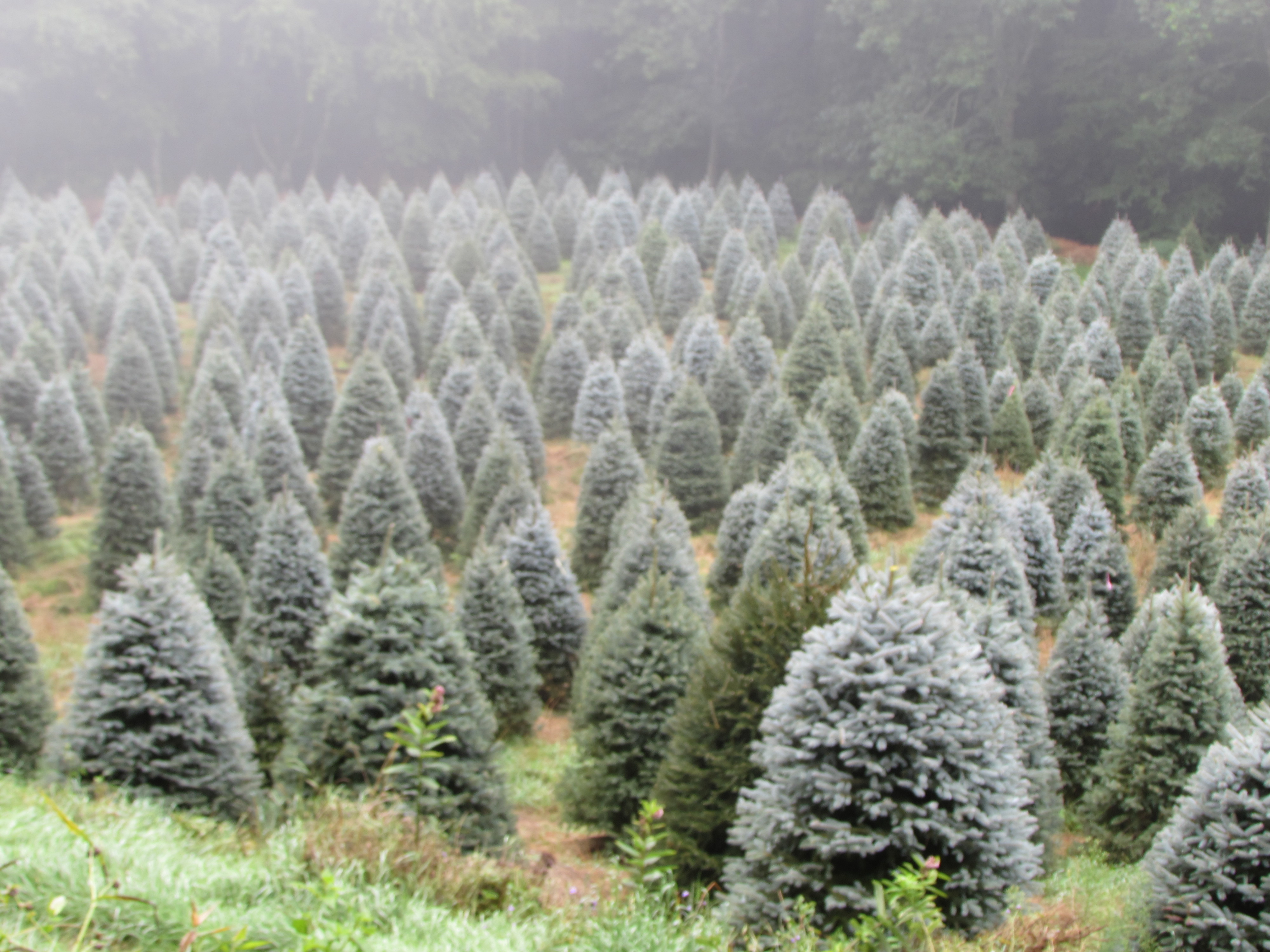 In fact, that never happened. The area around Laurel Springs has developed very slowly, if at all, with only minimal impact on the environment. Christmas tree farming is now the dominant agricultural industry in the area, replacing dairy farming, but it’s hardly an intrusive business, at least as far as I can tell. There are also more motorcycles now than there used to be, especially on weekends, but their increase has been offset by a decline in automobile tourism in the area. In other words, things have evened out over the decades, with every little growth balanced by a modest decline.
 The result is that the place seems to have kept its quiet charm without changing much one way or another. The fact is, Laurel Springs looks and feels much like it did forty years ago, neither booming nor dying.
But up the road, at Doughton Park, the future is more uncertain. A cloud has formed over the place, and it doesn’t seem to be dissipating. To explain what I mean, I should back up a bit.

The story often told about the building of the Blue Ridge Parkway involves President Franklin D. Roosevelt and Senator Harry F. Byrd of Virginia. In the summer of 1933, FDR’s first summer as president, he was touring a Civilian Conservation Corps (CCC) camp in Shenandoah National Park with Sen. Byrd and others when he was treated to a short trip on the new Skyline Drive. The President apparently so enjoyed the trip, with its spectacular views of the Shenandoah Valley, that Sen. Byrd remarked how nice it would be if the Skyline Drive were extended all the way down through Virginia to the Great Smoky Mountains National Park in North Carolina and Tennessee. The road, he told the President, would not only connect the two parks, improving access to them, but it would also bring jobs and tourist dollars to southern Appalachian communities hard hit by the Depression.

The idea for a scenic road through the southern Appalachians had been bandied about for a while. A “Crest of the Blue Ridge” highway, stretching 350 miles from Marion, Virginia, to Tallulah, Georgia, and passing through Boone, Blowing Rock, Linville, Little Switzerland, Asheville, Hendersonville, and Brevard, North Carolina, had been proposed as early as 1906 by Dr. Joseph Hyde Pratt of the North Carolina Geological and Economic Survey, but the idea did not survive World War I.

Then, when the Shenandoah and Great Smoky Mountains Parks were formed in the 1920s, part of an effort to bring western-style national parks to the eastern part of the country, proposals emerged to build a park-to-park connecting road that would help bring people to these remote areas. But it took the power of FDR, and the economic urgency of the Depression, to make Sen. Bryd’s vision of a great southern mountain road a reality. Even so, the ambition of the project, and the speed with which it was initiated, is breathtaking when viewed from our era of government gridlock.
By the fall of 1933, just months after the President first heard the idea, $4 million had been appropriated by the Department of the Interior to begin locating, designing, and building a scenic road between the Shenandoah and Great Smoky Mountains National Parks; and in December of that year the first employees were hired, including a young landscape architect from New York named Stanley Abbott. By late 1934, just a year later, the entire route had been plotted and land acquisition begun; and, in 1935, road construction began just south of the NC/VA state line, near what is today Cumberland Knob. In 1936, the Blue Ridge Parkway itself was established as an agency of the National Park Service. By the end of the 1930s, a third of the road, including the section through what is today Doughton Park, was complete. Soon after, construction halted for World War II, but, after the war, the goal of completing the Parkway was assisted by a massive influx of federal funds, and almost the entire Parkway was completed by the mid-1960s. For the next two decades, only a 7.5 mile stretch around Grandfather Mountain in North Carolina remained unbuilt, and when the Linville Cove Viaduct was finished in 1987, the Blue Ridge Parkway was officially completed, about 50 years after the project first broke ground.
Today, the Parkway travels an uninterrupted 469-mile route through two states, 29 counties, seven congressional districts, and the land of nearly 5,000 adjacent property owners. It was the first, and is perhaps still the most famous, “truly rural scenic parkway of such magnitude” in the world (Burggraf). It is also an innovative “linear” or “elongated” park with numerous wayside attractions. At the height of its popularity, as many as 21 million people a year rode it for some length, the most visited park in the U.S. National Park Service.

Blue Ridge Parkway Vicinity Map, 2013 General Management Plan
But the Parkway is not just a means of travel and recreation. From the beginning, it has interpreted, through its wayside exhibits and programs, the Southern Appalachians for the rest of the nation; it has been an important source of jobs and economic development for a historically poor part of the country; and it has preserved land and natural resources from private development, much as our other national parks have done.
-

- CCC workers, Doughton Park, 1940s
-

- Bluff Ridge Trail shelter, Doughton Park, built by CCC
The parkway is different from those other parks, however, by being essentially a road, even as it is different from most roads by being a park. The idea of a “parkway” can be traced back several centuries, but the immediate inspiration for the Blue Ridge Parkway was the Westchester County Parkways of New York, built between 1913 and 1930 and including the Bronx River Parkway, the Hutchinson River Parkway, the Saw Mill River Parkway, and the Cross County Parkway. There were several innovative features of these roadways: most importantly, they were designed for scenic pleasure and recreation, rather than simple convenience. They were thus curvilinear, not straight, with limited access and little or no cross traffic. Slower speed limits were instituted, and a relatively wide right of way was acquired to preserve views and landscapes. No billboards or commercial traffic (e.g., freight trucks) was allowed.

A publicly funded scenic parkway in a place like Westchester County, New York, however, was hard to preserve; and many of those roads today, although still comparatively scenic, are used for high-speed commuting, not pleasure driving. Still, the early influence of the Westchester Parkways on the design of the Blue Ridge Parkway is undeniable; in fact, Stanley Abbott, the Parkway’s first resident architect and later its first superintendent, was working for the Westchester County Parkways when he was hired in late 1933 to oversee the design and construction of the Blue Ridge Parkway.
What was unique about the Blue Ridge Parkway, compared to the Westchester roads, was its immense length, its end points in two national parks, and its truly rural location in a part of the country without great wealth. Abbott’s design for the Parkway also introduced several elements not present, or not present to such a degree, in the Westchester County projects. First, and perhaps most important, was Abbott’s formula for the Parkway’s width, a formula which met considerable initial resistance. It involved outright acquisition of approximately 100 acres of land per mile of roadway – amounting to an unheard of right of way averaging approximately 825 feet, or 412.5 feet to either side of the roadway’s center. (By comparison, roads of the time were generally constructed with a right of way of 50 to 75 feet; even the right of way for the Westchester Parkways only averaged around 200 feet, one-fourth what was proposed for the Blue Ridge Parkway.) In addition to the outright acquisition of 100 acres per mile in “fee simple” right of way, Abbott fought for an additional 50 acres per mile (or another 400 feet total in width) in “scenic easements” – that is, restrictions on the development of adjacent private properties.

The beautiful views of the Blue Ridge Parkway were achieved, in other words, partly by siting the road along the crest of the mountains, partly by locating it away from population centers, but partly also by acquiring a wide enough right of way that its “natural” integrity would be permanently uncompromised. As historian Anne Mitchell Whisnant has put it, much of the visual appeal of the Parkway is “borrowed” from its neighbors: what you see from the road is not necessarily Parkway land. This was the genius of Abbot’s vision: “the horizon would be the boundary . . . there would be nothing in view from the Parkway for as far as the eye could see that would displease the traveler” (Swaim 44).
The second innovation can probably be traced to Abbott’s training as a landscape architect (Cornell, 1929): it was his emphasis on fitting the roadway into the landscape as naturally as possible. On the Parkway, there would be no at-grade road crossings, only a seemingly endless, gently curving, unobtrusive roadway. Every detail of the surrounding landscape, from road shoulders and parking overviews to split-rail fencing and stone guardwalls, to campgrounds and picnic areas, even the signage, would be designed in a way that “fit the Parkway into the mountains as if nature had put it there” (Gignoux 35).

Third, Abbott was convinced that the uninterrupted top-of-the-ridge siting of the Skyline Drive could not work for the 500-mile length of the Blue Ridge Parkway; visitors would tire of relentless mountaintop vistas. So the Parkway was designed for as much scenic diversity as possible, often traveling along the crest of the mountains but often descending into other, equally pleasing landscapes. The design was like “following a mountain stream for awhile, then climbing up on the slope of a hill pasture, then dipping down into the open bottom lands and back into the woodlands” (Swaim 45). As we’ll see below, this preference of Abbott’s for scenic variety is more evident in the northern part of the Parkway (including Doughton Park) than the southern, the route below Blowing Rock, NC, based on a more unrelenting “mountain-top” route than Abbott proposed.
Fourth, Abbott and his team were committed as much to cultural preservation as to natural preservation. True, there was more destruction, and relocation, of human presence in the siting and design of the Parkway than is generally thought; but in many places, the culture of the southern Appalachian people was preserved to an extent – for example, in the Brinegar and Caudill Cabins in Doughton Park.

Finally, a key part of Abbott’s design for the Parkway was its wayside recreation areas. His original idea was to provide some kind of “bulge” every 25 miles or so – a place for visitors to get out of their cars for part of a day, or more, and hike, picnic, view an exhibit, eat in a park restaurant, stay in a park lodge or campground, or shop in a park store. Additional land would be acquired in certain locations, going well beyond the 1,000 foot right of way used for the “linear” part of the park. These recreation areas would be the “gems” on the “necklace” of the Parkway. Five were planned and completed in the early years of the Parkway, including Doughton Park, the largest of them all. Although Abbott’s vision of 19 wayside parks was never fully realized, the Parkway is today known as much for these areas, attractions in their own right, as for the road itself.
Of course, a vision is one thing, implementation is another. If Abbot’s dream of the Parkway was of a road that looked like it had always been there, designed by Nature herself, the actual story of the Parkway’s location, design, and construction is as full of conflicts and contradictions, economic interests and human artifice, as any undertaking of its kind. The story of the routing of the Parkway, for example, could itself fill a book. Some of the literature about the Parkway treats its construction as a triumph of professional design, with landscape architect Abbott, and his two location engineers, Hendrik Van Gelder in Virginia and Edward Abbuehl in North Carolina, operating with carte blanche from Roosevelt and Interior Secretary Harold L. Ickes, carving their beautiful road through 500 miles of Southern Appalachians with only their aesthetic principles to guide them.
-

- Blue Ridge Parkway at Ice Rocks, Doughton Park, under construction
-
- Blue Ridge Parkway at Ice Rocks, Doughton Park
There may be some truth in that story when applied to the northern half of the Parkway, the route from the Shenandoah National Park in Virginia, across the James River, by the Peaks of Otter, Roanoke Mountain, and Rocky Knob, and through what was then Bluffs Park to Blowing Rock, North Carolina, a route which seems to have been arrived at relatively easily and approved relatively early in the process – in fact within half a year of FDR and Sen. Byrd’s trip to the Skyline Drive. But the story of the southern routing of the Parkway, from Blowing Rock to the Great Smoky Mountains, is another story altogether. Throughout 1934, the states of Tennessee and North Carolina fought a pitched battle on behalf of their preferred routes. From the point of view of Tennessee’s delegation, after arriving at Blowing Rock, the Parkway should veer sharply west into their state and then travel south over a somewhat lower elevation to the western gate of the Great Smoky Mountains National Park. This was the route, in fact, preferred by Stanley Abbott, who thought the North Carolina way too high, too rugged, and too expensive. There was also something to be said, politically, for a route between the two national parks that would be shared by three states, rather than just two.
But the North Carolina delegation, including Governor Ehringhaus, Rep. Doughton, and the business interests of Asheville, was adamant that the southern route should stay in North Carolina the whole way, proceeding from Blowing Rock through Linville and Little Switzerland, passing Mt. Mitchell, the Craggy Gardens, Asheville, and Mt. Pisgah, and ending in the Cherokee Indian Reservation at a new eastern gate to the Great Smoky Mountains National Park. It was a route that bore some resemblance to Joseph Hyde Pratt’s earlier plan for a “Crest of the Blue Ridge” highway, but it was largely laid out by R. Getty Browning, chief locating engineer for the North Carolina State Highway Commission. The route was high in elevation, dramatic in scenery, and expensive to build, requiring literally dozens of tunnels and viaducts, to say nothing of negotiating the many competing public and private interests along the way.
By the middle of 1934, the momentum seemed to be moving Tennessee’s way, but after several tumultuous public hearings, and who knows how much backroom dealing, Secretary Ickes wrote to the two governors in November, 1934, informing them that the North Carolina route had been selected. Both Anne Mitchell Whisnant and Richard Quinn tell the story in fascinating detail, but the ultimate reason why the eastern route won out will probably never be known. Was it, as North Carolinians have long held, that that way is simply more beautiful? Was it, as Ickes himself implied, that Tennessee had been the recent beneficiary of much federal largesse in TVA projects? Did FDR friend and North Carolina native Josephus Daniels (who had a home in the North Carolina mountains) play a role? Or was there opposition to Stanley Abbott’s stated preference for a scenic highway at a lower elevation than the North Carolina route, with its series of stunning mountaintop views?
The story of the Blue Ridge Parkway is also the story of thousands and thousands of complex, complicated, and often controversial real estate transactions. True, the Parkway in some places passed through national forest and other easy-to-acquire tracts of land, and in some places it was the beneficiary of large private donations (e.g., the Moses Cone and Julian Price tracts); but for much of its route, Parkway planners had to acquire the road’s right of way and scenic easements acre by acre, from thousands of private landowners, big and small, some willing to sell during hard economic times, others reluctant to give up any land or rights for a project they were uninterested in or even opposed to. The very beauty of the Parkway, and its “natural” fit into the landscape, in other words, belies its origins in a huge, legal, land grab, one in which government officials and agencies used their awesome power of eminent domain and condemnation to acquire the private property of American citizens, many of them uneducated and poor. At the same time, some large landowners with government connections, like the Doughtons, may well have benefitted financially from the project.

Detail of a land acquisition map for the Blue Ridge Parkway at Ice Rocks, Doughton Park, showing purchase of right of way from Frank Doughton, R. L. Doughton’s brother
The politics of all this is largely invisible when you drive the parkway today. Abbott’s dream of making the road look as if it were always there was in many ways realized; but that appearance is an illusion. This “natural” landscape was written by human beings, with very particular agendas in mind, on top of a landscape that was already written by social, political, and economic interests. And even after the land was acquired and the road built, the Blue Ridge Parkway continued to participate in the human conflicts and socioeconomic struggles of its surrounding culture, despite pretending not to.

The meadows, Doughton Park
Take, for example, one of the more disturbing periods in the story of Doughton Park. In a digital history project recently published online, students in Dr. Anne Mitchell Whisnant’s fall 2013 History 671 Introduction to Public History course at the University of North Carolina Chapel Hill describe officially-sanctioned racial discrimination at Doughton Park in its early years. Using both primary and secondary sources, they write about how, when the Park opened in the late 1930s, African American visitors were not allowed to use the “meadows” picnic area on top of Bluff Mountain, precisely the place where my parents brought us to run and play in the 1950s and ‘60s and where my siblings and I continue to walk today, often hiking from the lodge to Alligator Back through the beautiful and famous high meadows of the Park. Apparently, when the Park first opened, the “woods” picnic area nearby was open to all, but the “meadows” facility, deemed nicer, was restricted to whites only.
The meadows, Doughton Park
According to the students’ website, when a group of African American visitors from Winston-Salem demanded use of the meadows picnic area in July, 1941, Park Superintendent Stanley Abbott asked an assistant to draw up a “Negro Master Plan” meant to provide better (but still segregated) facilities for African American visitors to the Park. The plan was never implemented, but the students gloss over exactly how the problem was finally resolved, writing only that World War II came along and, after the war, National Park Service facilities everywhere were desegregated.
-

- Bluffs Lodge, Doughton Park
-
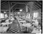
- Coffee Shop, Doughton Park
There are other ways in which the Blue Ridge Parkway has hidden its own particular brand of cultural and social violence. Take, for example, the Caudill Cabin at Doughton Park, such an important part of my own family’s history with this place. In a fascinating online article titled “Reinterpreting the Caudill Cabin,” Cassandra McGuire shows how the cabin was used by Stanley Abbott and other Parkway officials to perpetuate a distorted and, in some ways, pernicious view of the residents whose land was taken to build the Parkway and its recreation areas.
The Caudill Cabin from Wildcat Rocks
From the beginning, Abbott referred to the Caudill Cabin as an example of the “extreme isolation of mountain folk”; but McGuire reminds us that, before the 1916 flood, the cabin had not been isolated at all, that Basin Cove had been dotted with cabins, and that there had been anywhere from twenty to fifty families living in the valley, linked together by a shared church, school, and economic and social interests. The 1916 flood destroyed all that, though Martin Caudill’s cabin survived, a function of its location high up Basin Creek. Its “isolation,” then, was not an essential feature of the mountain way of life, as Abbott seemed to believe, but an historical accident. And yet early signage in Doughton Park not only mixed up details of Caudill family history and exaggerated the number of children who lived in the structure, it also perpetuated a stereotype about local residents that was simply untrue.

Early residents of the area have also often been represented as poor – dirt poor – even as squatters on their land, a perception that makes it easier to bear the stories of their later dispossession and relocation. But the Caudills, like the Brinegars, legally owned the land where their cabins sit today. The Brinegars owned over a hundred acres on the mountaintop along the northeastern corner of today’s Doughton Park; and, according to a 2006 “cultural landscape report” about this section of the Parkway, the Caudills owned as much as a thousand acres in the valley below Bluff Mountain (13). According to McGuire, one Caudill descendant has even claimed that Doughton Park ought rightfully to be called “Caudill Park.”

Who, then, owned Basin Cove when Bluffs Park was created in the late 1930s? The Caudills and nearly everyone else who had lived there left after the 1916 flood. But did they sell the land or just abandon it? And if they sold it, whom did they sell it to, and for how much? Randy Johnson, in his Hiking the Blue Ridge Parkway, writes that the whole Cove was purchased in 1930 by Robert Doughton – one imagines at a good price, given its recent destruction by flood and its abandonment by the families who once lived there. Occasionally, you read that Doughton later donated the land, over 5,000 acres, for the park that would one day bear his name. But all the accounts I’ve read of the acquisition of the Cove refer to its “purchase” in 1937-38, just as Section 2-C of the Blue Ridge Parkway was being built. If so, was it right for Congressman Doughton to profit, not only from the Caudills’ misfortune in 1916, but from his own role in the U.S. government’s decision to build the Parkway, to route it so close to his home in Laurel Springs, and to build its largest recreation area in a place where he and other family members were such significant landowners?
To complicate matters further, the land acquisition map copied here, from the Blue Ridge Parkway archives, shows Basin Cove in the 1930s as a hodgepodge of private parcels of land – there’s no indication that the whole thing was owned by any single person, whether a Caudill or a Doughton.

As we’ve seen, the Blue Ridge Parkway was meant to be a scenic drive through a beautiful and unspoiled southern Appalachian landscape. It’s nearly impossible, when you’re traveling the Parkway or walking in one of its recreation areas, not to appreciate its natural beauty. But I can’t help but want to see behind and under that surface. How exactly did this landscape come to be? What voices were silenced in its production? What conflicts suppressed in its final instantiation? What cultural assumptions are invoked in the very artificial design of this quintessentially “natural” landscape?
Finally, what’s so natural about a public park designed primarily for the private automobile? Isn’t that really what the Blue Ridge Parkway is: an outdated, outmoded testament to what Lewis Mumford once called the American “religion of the motorcar”?
All that said, the Parkway’s success over the last three-quarters of a century is irrefutable. The road and its attractions have for so long been so popular that one can’t help but admire the achievement of Stanley Abbott and others who designed and built it. According to focus groups in the 1980s, the Parkway has provided a welcome escape from the stress and routine of everyday life, an opportunity to view the scenic beauty of the Virginia and North Carolina mountains, an important contribution to local economies through travel and tourism, and needed recreational opportunities. In addition, according to Barry M. Buxton and Steven M. Beatty, “Perhaps no other road in the world interprets the natural and cultural history of a region so well as the Blue Ridge Parkway does the Southern Appalachians” (i).

Basin Cove, Doughton Park, NC
But can the Parkway survive into the twenty-first century? In a massive management plan published last year, Parkway officials acknowledge a host of pressures that are prompting a rethinking of what the Blue Ridge Parkway is and how it should adapt to changing times. They include increased private encroachment on the Parkway from housing and business development, especially around such population centers as Roanoke, Boone, and Asheville; new kinds of road use – especially by motorcycles, bicycles, and recreational vehicles – that Parkway planners simply did not envision; and, of course climate change and other threats to the health of the Parkway’s flora and fauna. But perhaps the two most pressing challenges facing the Parkway today are, first, eroding public investment in such shared national, state, and local resources, and, second, declining visitorship to the Parkway itself, probably the most surprising and worrisome development of all.
In the early 1960s, the U.S. Outdoor Recreation Review Commission found that “driving for pleasure” was the most important and frequent recreation activity of Americans. If you asked young people today about “driving for pleasure,” I’m not sure they would even know what you meant. I’ve written in other posts about declining rates of automobile ownership and use in our country, especially among young people. Can the parkway survive such a huge generational shift away from the private automobile, and automobile touring – a shift that, in most respects, is probably a good thing for the planet?
-
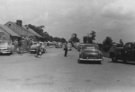
- Doughton Park Coffee Shop in the 1950s
-

- Doughton Park Picnic Area in the 1950s
And does that shift account for declining use of the Blue Ridge Parkway? According to an article in the Roanoke Times, in 2013, the Parkway attracted its fewest visitors since 1979: 12.8 million visitors, a drop of 40 percent from the all-time high of 21.5 million in 2002. According to the National Park Service, the drop “was primarily due to several lengthy weather-related road closures during the first three months of 2013,” as well as the government shutdown of October, 2013. But a downward trend in Parkway use has been noted since at least 2003.
Meanwhile, an increasingly stingy federal government has cut the Parkway budget so much in recent years that staffing there has declined over the last decade from 240 full-time employees to 170. The cuts have affected services, leading to closed facilities all along the Parkway, even during high season, and even at attractions like Doughton Park, which has closed popular facilities like its picnic grounds for extended periods in recent years.
In fact, Doughton Park may well be ground zero in this cultural shift in the use of our national parks. In 2011, much to my family’s disappointment, the Park closed, for the first time in more than 60 years, its famous lodge and coffee shop, claiming that it could no longer find a concessionaire willing to manage them. For three years now, we have waited for the facilities to re-open, but they remain empty. The official position of the Parkway is that the closures are temporary, but it’s impossible not to fear that one day we’ll drive up to Doughton Park and find wrecking crews leveling the old structures and allowing the land there to return to forest, meadow, and wilderness.
-

- Doughton Park Coffee Shop, closed
-

- Bluffs Lodge, Doughton Park, closed
Maybe that wouldn’t be such a bad thing. In the 1960s, as the “Unbuilt Doughton Park” website shows, two very different visions for the future of Doughton Park were proposed. In one, the Park would expand dramatically, the size of both the lodge and coffee shop doubling and a visitor’s center and other new amenities built. It was a reminder of Stanley Abbot’s original vision for Doughton Park, in the mid-1930s, which included a man-made lake and golf course in Basin Cove.
In the other, very different, proposal, all the land in Basin Cove would be designated a federal wilderness area, forever protecting and preserving that tract in as wild a state as possible.
For good or ill, neither proposal was adopted, and, in a sense, Doughton Park, like the Blue Ridge Parkway that travels through it, has stood still for more than 50 years, essentially stuck in the past. As the “Unbuilt Doughton Park” authors put, “Since 1969, Doughton Park has been in an elongated phase of atrophy.”
It’s a worrisome situation. But for now, all I can think about is summer in Laurel Springs: the chill air of morning, the sweet breeze of midday, the sound of crickets, unending, at night. Walking down the gravel drive in the afternoon, I can hear the tinkling sound of a small creek, the rustling of the underbrush. Peering up, I have never seen such green in all my life. And from the Parkway, looking out at the far horizon, the mountains fade softly into blue – mountains as far as the eye can see.
Works Cited
The Blue Ridge Parkway’s most recent General Management Plan was published in Asheville, NC, Jan., 2013. It can be downloaded here.
The Cultural Landscape Report for Doughton Park and Sections 2A, B and C, Blue Ridge Parkway, written by the Jaeger Company under the direction of the National Park Service, was published in Asheville, NC, in 2006. It can be downloaded here.
Barry M. Buxton and Steven M. Beatty (eds.)’s Blue Ridge Parkway: Agent of Transition was published in Boone, NC, by the Appalachian Consortium Press in 1986. It includes chapters by Gary Everhardt, Frank B. Burggraf, Leslie Gignoux, and Douglas Swaim, among others.
Barry M. Buxton’s Brinegar Cabin Historic Resource Study was published by the Blue Ridge Parkway, National Park Service, U.S. Department of the Interior, in 1988. It can be downloaded, along with the official 1949 Blue Ridge Parkway Guide Book, here.
“Driving Through Time: The Digital Blue Ridge Parkway” can be found here. It includes Anne Mitchell Whisnant’s “Routing the Parkway, 1934” and Cassandra McGuire’s “Reinterpreting the Caudill Cabin,” among other resources.
Environment America’s Death by a Thousand Cuts, America’s National Park System: Underfunded & Under Threat, published in Jan., 2014, can be found here.
Randy Johnson’s 2010 blog post, “Basin Creek Trail to Caudill Cabin in Doughton Park,” which includes the video of his hike to the Caudill Cabin, can be found here. His book Hiking the Blue Ridge Parkway (A Falcon Guide) was published by Morris Book Publishing in Guilford, CT, 2003.
William G. Lord’s The Blue Ridge Parkway Guide, Section B, from Roanoke, VA, to Blowing Rock – Boone, was published by The Stephens Press in Asheville, NC, 1961.
The July 22, 2014, Roanoke Times article about declining visitorship on the Blue Ridge Parkway can be found here.
Richard Quin’s report on the Blue Ridge Parkway for the Historic American Engineering Record, HAER Report No. NC-42, was published by the National Park Service, U.S. Department of the Interior, 1997. It can be downloaded here. HAER photographs and drawings of the Parkway at the Library of Congress, Prints & Photographs Online Catalog, are available here.
Donald H. Robinson’s Camper’s and Hiker’s Guide to the Blue Ridge Parkway was published in Riverside, CT, by The Chatham Press in 1971.
The “Unbuilt Doughton Park” project (fall 2013) can be found here.
USGS Topographic maps, like the two of Whitehead Quadrangle, NC, used above, can be found here.
The official website of the Blue Ridge Parkway is here. For official maps, click here.
The website of the Blue Ridge Parkway Association is here.
The website of the Blue Ridge Parkway Foundation is here.
The website of the Friends of the Blue Ridge Parkway is here.

I loved this David. Wish I was there right now.
My husband and I have hiked to the Caudill Cabin several times and hiked most, if not all of the trails there. Our family has a mountain home in Laurel Springs, just 8 miles down from Doughton Park campground where we have tent camped for years. Sadly, a couple of years ago to our dismay, most of the campground had been closed and the picnic area was also closed. Many people came from all over to picnic there during Labor Day weekend only to be shocked that the picnic area was shut down. They had to pull off on the side of the parkway to have their picnics. I couldn’t understand why this had been done to the park. It can’t cost that much to maintain the picnic area. The best part of the campground, loop “C” was closed. Very sad to see this beautiful place disappearing.
I too feel this way. Going to Doughton Park at the picnic area was something we looked forward to in the Summer and Fall. I was stunned to find out that it was closed. It makes me feel very sad to see what is happening to the Parkway. It is not maintained like it used to be. We hated it so bad when the Coffee Shop was closed. We went there so many times in the past…
I went to doughton park every summer with my dad. Just him and I. We wiuld neet his family there,. I was adopted, essentially, by him. It was the only sense of family gathering I had, going to the lodge and restaurant. I am with a woman who I love very much now and wanted to show her that area, those places. I have quite the defeated fealing now. And a pang of nostalgia.
I am so sorry to see this happening to The Parkway (that’s all our family needed to say). I remember many Sundays when our family drove there to get a little “air.” We often took a picnic lunch and parked wherever there was a wide grassy area. This was 60+ years ago and my sisters and I still drive up there whenever we have a chance. Many of our ancestors are buried in the Sheets Cemetery. One reason it felt so much like home is that it is, or was, home to my Grandparents and their five children, including my Dad. The Sheets Cabin still stands just off the the road. Much of it is gone now, leaving only the central room intact. A single log is the base of the structure on either side. It is amazing. We frequently pull to the side of the road and sit in the grass, trying to imagine living there in the winter. Summer, of course, would be wonderful. Further ties to The Parkway include the fact that the road went through property owned by our family. Only a small section was left for us and that later disappeared. Another tie is that my Dad worked on The Parkway. Cutting away the rock was a monstrous task. It’s so sad to see accommodations deteriorate and close down.
I still live on the parkway, and am also an ancestor of that same Sheets Family, the land I live on has been passed down through many generations and joins the parkway boundaries at Sheets Gap. I am so blessed to call this home, I left for over 25 years after high school and always longed to come back home, finally 7 years ago I achieved my dream, I am here never to leave again.
Sitting in my vacation house on Air Bellows Gap Rd after finishing a 15k run on the BRP in Doughton Park. Excellent article. I grew up in Alleghany and hope to retire here soon. I hope the govt gets it together on the the park facilities. we must not lose this treasure.
Thanks. For the memories
I’m Martin Caudill’s great-grandson. My son, my brother and I are the guys in Randy’s video from 09′.
You have a lot of questions about the cove and I have a lot of answers.
This is an amazing article. I’ll have to spend time pouring through carefully.
Thank you.
– Lenny
I am also a descendent of the Caudill family. My Great Grandfather was Schooler Colfax Caudill, who I believe was a cousin to Martin Caudill. My family still calls the area off of Absher Road home. I still live in the county, but in Millers Creek now. I still have a brother and sister and two cousins who live on what is now Moxley Road. I am very proud of my heritage. It is so sad to see how the Parkway is not maintained in the same way as in years past. You always hope that the land will be something that your children and grandchildren can be proud of and stand on that overlook looking down at that little cabin and say, like I have, “that’s my family” Really enjoyed this article.
As Lenny is attached to the area so am I. I am the granddaughter of Pheode Caudill Pruitt, born in the little Caudill cabin. It was our relatives who died in the 1916 flood, Lenny being the grandson of the Caudill that lost his young bride and a brother. Growing up we probably were on the parkway at least once a month. Had Sundy School picnics on every 5th Sunday in the summers. It felt like home. Later years after marrying, my husband and son would mountain bike down those trails to the cabin and end up at Basin Creek. I guess it was a simpler time, a slower paced time, and I so miss it. Thank you for the wonderful article and thanks to Lenny for remembering the centennial of the flood this year. I am sad for the generations that will not have that experience in their lives.
I have family that lost land to the parkway when the government was condemning the land and forcing local land owners to sell for pennies on the dollar. The land is beautiful, prime property in the area of Blowing Rock, NC. The original land owners died many years ago, but I have cousins who still feel the sting of loosing their legacy. I remember stories of land owners in the Bamboo area meeting government officials at property lines with guns. These people still have their land and it’s still being handed down, generation after generation as it should be.
Growing up, going up the “the Scenic,” as my daddy would say, was a special treat. Only in the past few years have I learned how many people lost land to the government due to the parkway. I’m thankful for those who fought to keep their land, as I am a believer in private property. Maybe the proverbial chickens are coming home to roost for a government that took away land from families. As much as I love the parkway, it’s important that people know about the government’s swindling of landowners. There is hardly a better way to keep land in good shape than to pass it down through generations.
Hi, just found your post and appreciate the links and mentions of my and my students’ work. I am eager to spend time reading this carefully. My students this fall (2014) are doing a new project on Parkway recreation areas including other takes on Doughton Park. Watch for their site to debut in Dec/Jan. –Anne Mitchell Whisnant
Dr. Whisnant,
Keep us posted on the research results from the students ‘ work in 2014. Thanks for keeping students involved.
So enjoyed my tenure as the General Manager of Bluffs Coffee Shop Restaurant and Bluff’s Lodge, April 2005 – November 2010.
Bluff’s had so many wonderful employees and customers; all of whom became family. Employees returned each year, working there up to 61 years; customers made repeat visits just as many years.
Some even related the stories of the building of the Parkway.
And, if we could wave a magic wand, we would do it all over again.
How can we save the Lodge and Coffee Shop?
We all must do something. If you have ever been there,
you will understand why it is so important to save for the future.
The list is long and costly to fix the buildings and systems due to both age and the past 5 years of neglect. In addition, the prospect of buying out Forever’s holdings still on property is rather substantial. Next, is creating a plan to provide for a profitable operation; or, at least an acceptable negative figure. 2006 was a banner year, in that we only lost $ 20,000; most years it was well over $100,000 in the red. Of course, those included management fees, etc going to Forever. Gift shop; travel/camp store; perhaps a c-store type place; beverage service ‘to go’; all are do-able. On the Lodge side of things – we averaged about 90% fill rate; price should be higher than they were, which was just under $100 avg per night. On the other side, there continues to exist a cadre of experienced staff; kitchen, serving, maintenance and operations supervision who are ready and willing to return; however, the numbers are declining with each passing year.
So, bottom line answer to your question – money.
Bill H
918 465-5737
BillH52@yahoo.com
Eric,
There is good news on the horizon regarding the Bluffs lodge and coffee shop. In talking with the new Parkway superintendent in August, he has assured me that they both will be reopened but will take a while. Funding is one issue, Both facilities have become infested with mold since their closure. To get rid of the mold will take about one million dollars. The superintendent did say that the restaurant will be reopened first but may take until 2017. Our plan, as a chapter of FRIENDS of the Blue Ridge Parkway with these facilities in our region, is to make certain that these openings take place as soon as it is feasible. We make certain that these facilities remain on the radar as work is being done in other areas of the Parkway. Keep your fingers crossed for us. Join us in our efforts. You can find us on the FRIENDS website. We are the Northern Highlands Chapter.
Thank you for your interest.
Bill,
It is good to see you on here. I agree Money will be the biggiest issue.
You and the staff did great in leaving a great impression on all that visited.
I was last at the Coffee Shop in 2011 and told the Lady that served me, that I had eaten there many times as a kid. She said she most likely served me. She had been there since right after it open.
I do hope a group sits down one day soon and come up with a solution. I still realize money is the issue, but it is emotional for me. Thanks you Bill, keeping up on this issue.
The problem is that the state requires any potential concessionaire to have in the neighborhood of a million dollars up-front for initial operating costs. With relatively modest revenue generated by the facility, who could afford to do that? The big resort companies have no interest in such a quaint little facility, and the sort of folks who would love to run a homey place like the Bluffs simply cannot come up with that sort of operating cash plus paying to the “man” plus doing necessary updates and maintenance. It’s a shame. I think I speak for many of us when I say that if I could do it myself, I would–it would be a dream opportunity. If only.
It boils down to the men and women in and around
the White House, where they give the tax dollars,
foreign countries or here at home. I grew up within
Sight of the Parkway, my Dad ,as a child, spent the
Night in Brinegar’s Cabin,later worked over 20 years
there. The money is there, but controlled by the
politicians .
Since Our First Visit (1977) Doughton Park Became Our favorite Area To Visit. Pleasant Summer Days And Cool Nights At Bluffs Lodge Became The Magnet That Brought Us Back Year after Year. My Aunt Who Came With Us The Year Before Bluffs Lodge closed Loved Sitting Around The Outdoor Fireplace After A Wonderful Dinner At The Bluffs Rest. Good Conversation, Children Toasting Marsh Mellows Over The Crackling Wood Fire, My Aunt Who Was Ninety Three At The Time Became Young Again, Even Getting Up To dance To A Tune Being played By Another guest. As Darkness Closed In Everyone Seemed To Slide Closer And Closer To That Warm Fire Until One By One We Retired To Our Respective rooms For A Good Nights Sleep Under The Thick Warm blanket In Each Room. No Air Condition Needed Here. The Next Morning At Breakfast Everybody Knew My Aunt from The Night Before And Called her Aunt Lilly. Needless To Say, She Began To Discover And Love The Personality Of This Place, And That Personality Being A Person Becomes Younger, A Friendlier, More Open To conversation Person, A Person more Content To Slow Down For Just A Bit , Even Food Taste Better Here. Stars are brighter And The Air Fresher Here. Now Quietly Waiting, Waiting To Pass Out Gifts To Anyone Passing Her Door. We Love You Doughton Park.
This was a fantastic piece, thank you for sharing it online. We are going camping at Doughton Park tomorrow. It seems that there are more cut-backs in that park every year recently. A large portion of the campground has been closed for a few years now, including the campfire circle and the educational programs that went on at that circle. The Brinegar Cabin is no longer staffed every day, and there are less rangers working that park all around. We will go there as long as any of the park is open to us because we love the area, the people, the scenery and everything else that place has to offer. Whether car camping in Doughton, or fly fishing and backpacking into Basin Cove, every minute spent there is wonderful and all who love it should do all we can to keep it thriving.
I am the owner of Doughton – Hall B & B, formerly known as The Doughton House. I found the article very well written but wish the ening wasn’t true. We have so many guests coming from the parkway and have to constantly reply to their questions as why it’s so run down. We were just there this past Saturday 7- 25-15. We stopped at Moses Cone and I have never seen it so crowded! They were parked along both side of the drive as well as parkway. The Ranger even toldme Iit was the best day he had seen in years. Too bad the grass was so tall no one could pull over for an old fashioned picnic. Not to mention, pull over at the overlooks. Trees and bushes is all you can see from most of them. Of course there is so place to eat, get refreshments, gas or even bathrooms. Which may have been the reason for so many at Moses Cone. Because the line was so long for both male and female we left and got off the parkway for bathrooms and dinner. Needles to say we continued back home via 421 and 88. The parkway itself is so bad grass is growing up in the broken pavement. Much better ride off the parkway at least you can spot wildlife before you hit them crossing the road. Again, great article, sad but true….
just a great documentary on Doughton Park. Brings back many childhood memories any also many historical fact of which I was unaware.
The childhood home i grew up in is in a community that joins the parkway and it always was part of our lives growing up. My mother worked at the coffee shop at doughton park and my uncle retired as a park ranger and my uncle helped build the parkway. My grandfather lived in laurel springs so we would travel the parkway on sunday afternoons from our home in the cherry lane community for a visit sometimes stopping with a picnic and the highlight was the trip home at dusk when we would see the deer grazing in the meadows. I feel if the parkway is left to fall to needs of repair as it is now we will loose some of the most beautiful areas of our country for our children and they will loose the joys we had growing up in this beautiful area.
Thanks for the memories of Doughton Park..i grew up in Elkin and most week-ends were spent at Doughton Park for a picnic or the meadows where the huge rocks were located. Have pictures taken of our Chatham family taken on top of rocks.. We would spend the day and hike all over the place. In later years we would drive up to the Bluffs to get country ham biscuits and cherry preserves. My Aunt Louise Mayberry worked at Brinegar Cabin 2 summers, if I remember correctly..After moving away from NC to Florida in 1946, every visit had to be a meal at Doughton Park.. What wonderful memories for an 85 year old tar heel. Thank you.. You have made my day..
Thanks for the great article on Doughton Park. I have great memories of the park. The last time I was there, the coffee shop was closed, such a nice place.
I worked from this site many times as a park employee . I wish for an enthusiastic new bidder to take it on and bring it back in full partnership with the park and the public and give it back its life. I too have wonderful memories of good work with local folks achieved at meetings with Doughton Park as the host and teacher. Financial strain on all the parks is real… Doughton Park’s revival will take generosity in the private business sector to accomplish. 2016 is the 100th of the NPS. Wouldn’t it be a great tribute to the best of values to see DP taken on and reopened?
wow! amazing writing and story – leaving me with tears in my eyes. I grew up quite a bit further east in NC, Saxapahaw (rural route Graham) in Alamance County. My ancestors (both sides) have lived long in Orange, Alamance and Chatham counties,.
I was so shocked and saddened when I first heard that the Bluffs Diner at Doughton Park had closed. We had been going there for many years. We had a cabin right off the Parkway about 10 miles away, towards Sparta. I always looked forward to breakfast at the Bluffs. They had the best biscuits and homemade cherry preserves and the coffee, I can smell it now. It was a wonderful experience every time. There was a waitress that had been there for more than 50 years! It was just a very unique place. I just can’t believe that it has not re-opened because it always did such a good business and we thought it was very much needed for travelers on the Parkway. I hope and pray that it will re-open someday soon. We really miss that place.
Thank you for this wonderful remembrance and concern for the future. In the late 1970s Doughton Park was the first area I visited on the Parkway and it remains my favorite. (First-love syndrome?) So very sad that the lodge and coffee shop have been shuttered for several years now, with no apparent plans to reopen either.
Blue Ridge visitors climbed to 15 million according to the Roanoke Times, partially contributing was the warm weather in December. A good sign for any business along the Parkway. So lets hope Doughton Park can make a comeback.
Great article, very well written. I’ve noticed that the restaurant has a lot of construction taking place. Hoping this is a sign that the park will be rejuvenated soon. Still such a beautiful place!
Great article! My wife and I hike nearly every weekend and we typically hit Doughton trails four to six times a year. We love the diversity and flexibility of the park trails. I’m always amazed (and happy) to find so few people up there, giving us plenty of room to ourselves.