
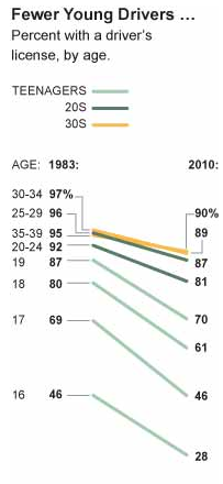
Our nation’s love affair with the car continues to wane. As the New York Times reported recently, “Americans are buying fewer cars, driving less and getting fewer licenses as each year goes by.” This decrease in “automobility” is especially striking for young Americans, who are clearly less smitten with the car than their parents were at the same age.
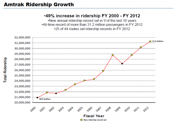
Accompanying the decline in private automobile usage has been a surge in mass transit. According to the American Public Transportation Association, 10.5 billion trips were taken on U.S. public transit systems in 2012, the second highest total since 1957. Ridership on Amtrak, meanwhile, has increased nearly 50% since 2000, with March 2013 the single biggest month in its history.
A contributing factor behind all this must be the Great Recession, with its high gas prices and stagnant wages. But the shift in transportation habits began before the housing bubble burst and the unemployment rate started to rise. One theory has it that young adults today are just too wired to drive; they’d rather spend an hour sitting in a bus or train, connected by smart phone to their family, friends, and coworkers, than behind the wheel of a car, at risk of distracted driving, or in a cramped airplane seat, waiting to be told they can turn their devices back on.
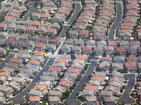
But I think something deeper is going on. As suburban living continues to lose its appeal in this country, the private automobile is finally releasing its hold on us. Suburbia used to be, in our minds at least, a land of prosperity and well-being; now it seems more like a land of debt and isolation. As for the vehicles that promised us so much freedom? They turn out to be just a lot of dead weight: depleting our bank accounts, polluting our air, contributing to our obesity, alienating us from the natural world and one another. Cars have their uses; but a place where you can’t work, shop, socialize, exercise, or worship without one is probably not a very good place to live. Young people seem to know this – which is why they’re settling in places with walkable neighborhoods, accessible greenways and bike paths, and convenient public transportation. Such places turn out to be among our most attractive, diverse, and dynamic communities. They allow people to live a good life without being dependent on cars; and that independence leads residents to expect even more from them.
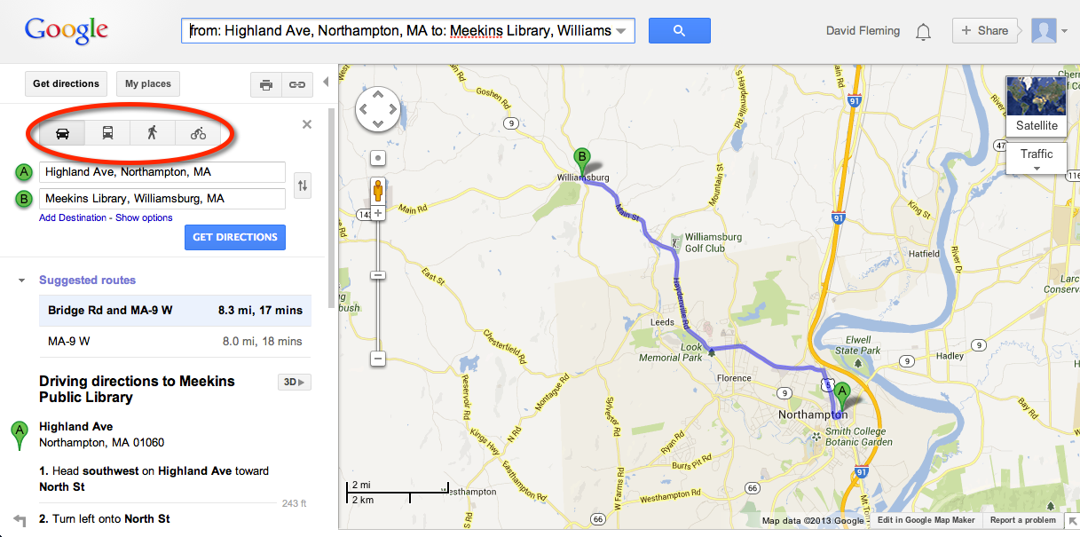 Which brings me to the history of Google Maps. OK, I know that must seem like a stretch, but soon after I read the New York Times article mentioned above, I found myself looking at Google Maps. I don’t remember where I was going or what I was searching for, but what I noticed on my screen were the four icons on the left, sitting side by side in seeming equality: a car, a bus, a walker, and a cyclist. It got me wondering: could the growing prominence of these other modes of transportation in online mapping programs be a further sign of the declining role of the automobile in our culture?

Believe it or not, Google Maps is only a little older than a first-grader. And yet it now claims one billion unique users every month. Increasingly, those users are looking for more than driving directions. True, when the service started, in 2005, it was oriented almost exclusively to the automobile. But by 2007, Google Maps was already providing public transit directions for some cities. Then, in 2008, walking directions were added; and, in 2010, biking directions, now available for about 150 U.S. cities. In many locations today, when you go to Google Maps and click “Get directions,” you have four transportation modes to choose from: driving, mass transit, walking, and biking.
The default is still, of course, driving – you have to click one of the other icons to change the mode. And both walking and biking directions seem to be in perpetual beta, often with stark warnings. Biking directions, meanwhile, are still not available on either Apple Maps or Google Maps for iOS (at least on my iPad). And there seems to be only one criterion for directions on Google Maps – speed – which shouldn’t be the only criterion, in my opinion, even for cars. Still, online non-driving directions are bound to get better; and one wonders if non-driving itself – that is, walking, biking, and public transit – might get better, too, as people increasingly ask their digital devices about it.
I wanted to know how the different modes compare, both on screen and on the ground. What happens when you change the mode of transportation in Google Maps? More crucially, what happens when you change the way you move around in your actual world? And what kinds of experiences do those different modes of travel afford? Might the online and real worlds mutually effect one another, so that what we see and do on screen could help us live better lives on earth, and the ways we live in reality could feed into better digital tools?
Google itself doesn’t offer side-by-side comparisons of the different modes of transportation, but at least one programmer, Michael Schade, has developed an application, called Side-by-Side Router, that does just that. Here’s a sample map, using his program, that compares Google routes for driving (red), transit (purple), walking (blue), and biking (green) from Arlington Cemetery to Capitol Hill in Washington, DC:
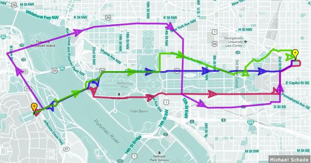
The problem is that Schade’s program, as far as I can tell, chooses only one route for each mode, even though Google Maps often provides multiple routes per trip. And Schade’s criterion for that choice, which also seems to be the impetus behind the tool itself, is speed: what’s the fastest way, especially for commuters in large metropolitan areas, to get from point A to point B? Finally, the comparison is almost exclusively visual, though no map can tell you what the experience of traveling along a certain route will be like. For that, you need words. And images. And you need to get off your butt and try the routes out.
So, as an experiment, I thought I’d travel four times to the same place in my own world, each time using a different mode of transportation. My destination would be far enough away that there would be some adventure in getting there, but close enough that I could do each trip within a single morning or afternoon. I would use Google Maps to plan each journey, but I wouldn’t restrict myself to the routes suggested there – in fact, I would depart from Google, if needed, to ensure that the four trips were as distinct from one another as possible. After all, my purpose was not just to test Google Maps but to learn about my own world and the different ways to get around in it.
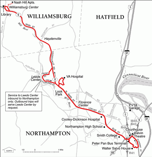
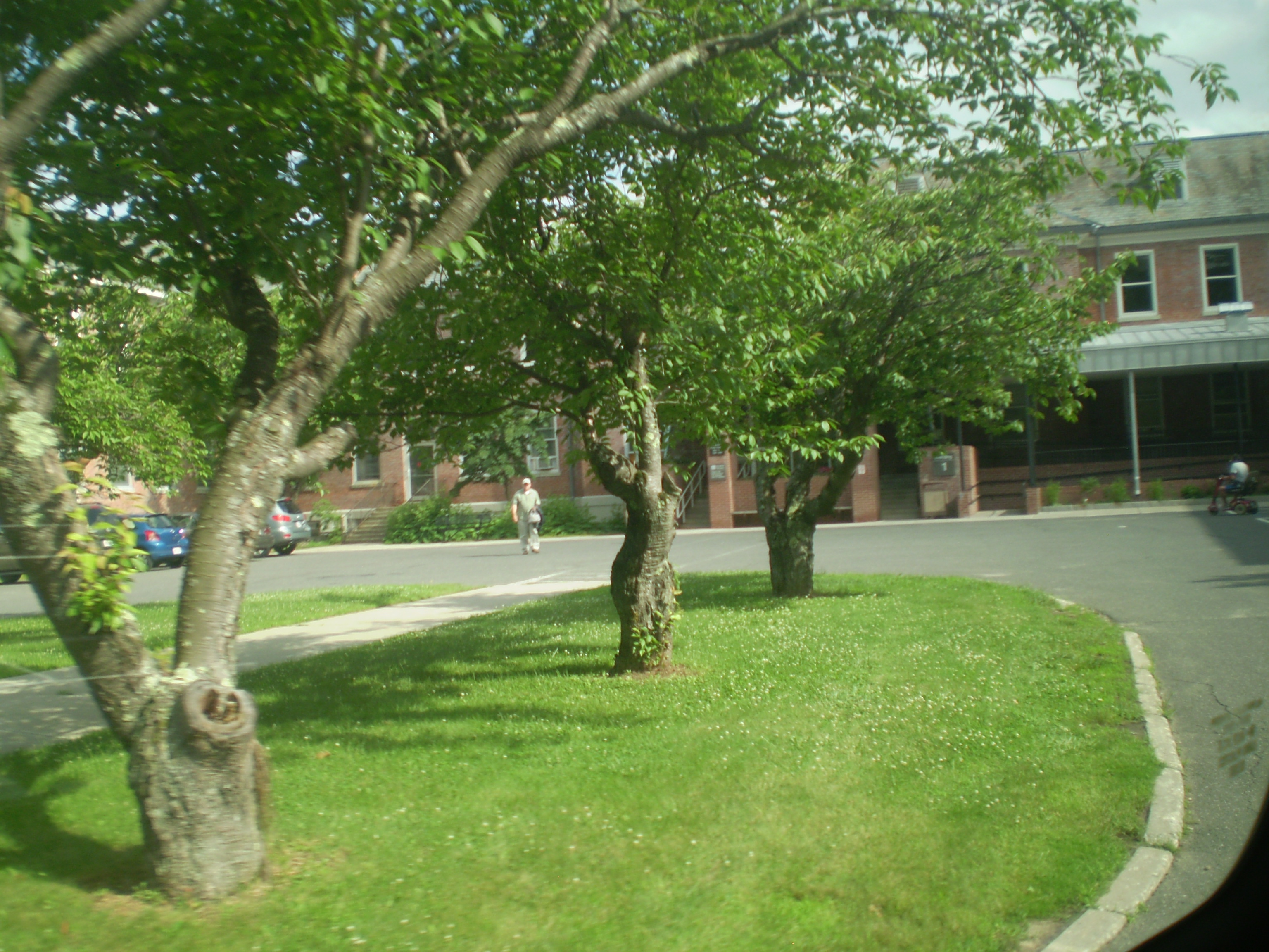
I decided to travel from my house in Northampton, Massachusetts, to Meekins Public Library in Williamsburg, Massachusetts, about 8 miles away by car.
Here are the results of my experiment.
 July 2, 2013: Taking the R42 to Williamsburg

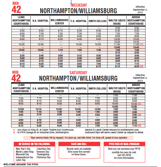
The Red 42 is a bus route operated by the Pioneer Valley Transit Authority of Western Massachusetts. The route runs between Northampton and Williamsburg, though it’s probably most often used for getting patients, employees, and visitors to and from the VA Hospital, located on Route 9 between the two towns. Although I’m a frequent user of PVTA buses, I had never been on the R42; and, because I knew I would be entirely dependent on the PVTA for this part of my experiment, I decided to do the transit journey first.
The PVTA operates buses in and around 24 communities in Western Massachusetts, including Northampton, Holyoke, and Springfield. It also connects the campuses of the Five College consortium of Western Massachusetts: Amherst, Hampshire, Mount Holyoke, and Smith Colleges and the University of Massachusetts Amherst. Bus travel for Five College students, faculty, and staff is free during the school year, so the PVTA is well known in the higher education community here. Because of the inter-campus routes, it’s said that the PVTA operates the second-largest free-fare public transit system in the world.
The R42 runs every hour or so from early morning to early evening, six days a week (there’s no service on Sunday). Since the Five College free fare doesn’t apply in the summer, I needed to have $1.25 in exact change for each leg of the journey. So I stopped at the 7-11 on King Street and asked for change. It was a Tuesday, and I had decided to take the 2:25 pm bus from downtown Northampton, arriving in Williamsburg around 3:00 pm, and then board the 4:15 pm bus for home. I would spend the intervening seventy-five minutes at the Williamsburg public library.
I arrived at the courthouse around 2:15 or so and waited with other prospective passengers.  When the bus pulled up at 2:30, I took a photograph before boarding, knowing that I would be blogging about this trip. On entering the bus, though, I was told by the driver that the PVTA forbade such practice and asked to delete the picture in front of him. This was very disappointing!

 Fortunately, once inside the bus, my attention shifted quickly to my fellow passengers, a diverse and interesting lot, as it often is on buses around here. When I boarded, an older gentleman was talking to the driver about a recent visit to the White Mountains. Later, a young man joined in. They talked with awe about the record wind speeds and freezing temperatures on Mt. Washington. We soon pulled up to the VA Hospital; four passengers got off, leaving only three of us for the rest of the trip. Then one of those three got off in Leeds. We rode through Haydenville in silence.
For all the inconvenience of the bus – I had to have exact change for the fares, I was at the mercy of the PVTA schedule, I had to listen to other people’s conversations and wait for their stops – riding public transit can be oddly relaxing: you can read or watch other passengers or just stare out the window. I had literally nothing to do, no decisions to make, no efforts to exert. Someone else did all the work, and I just sat. It was kind of nice.
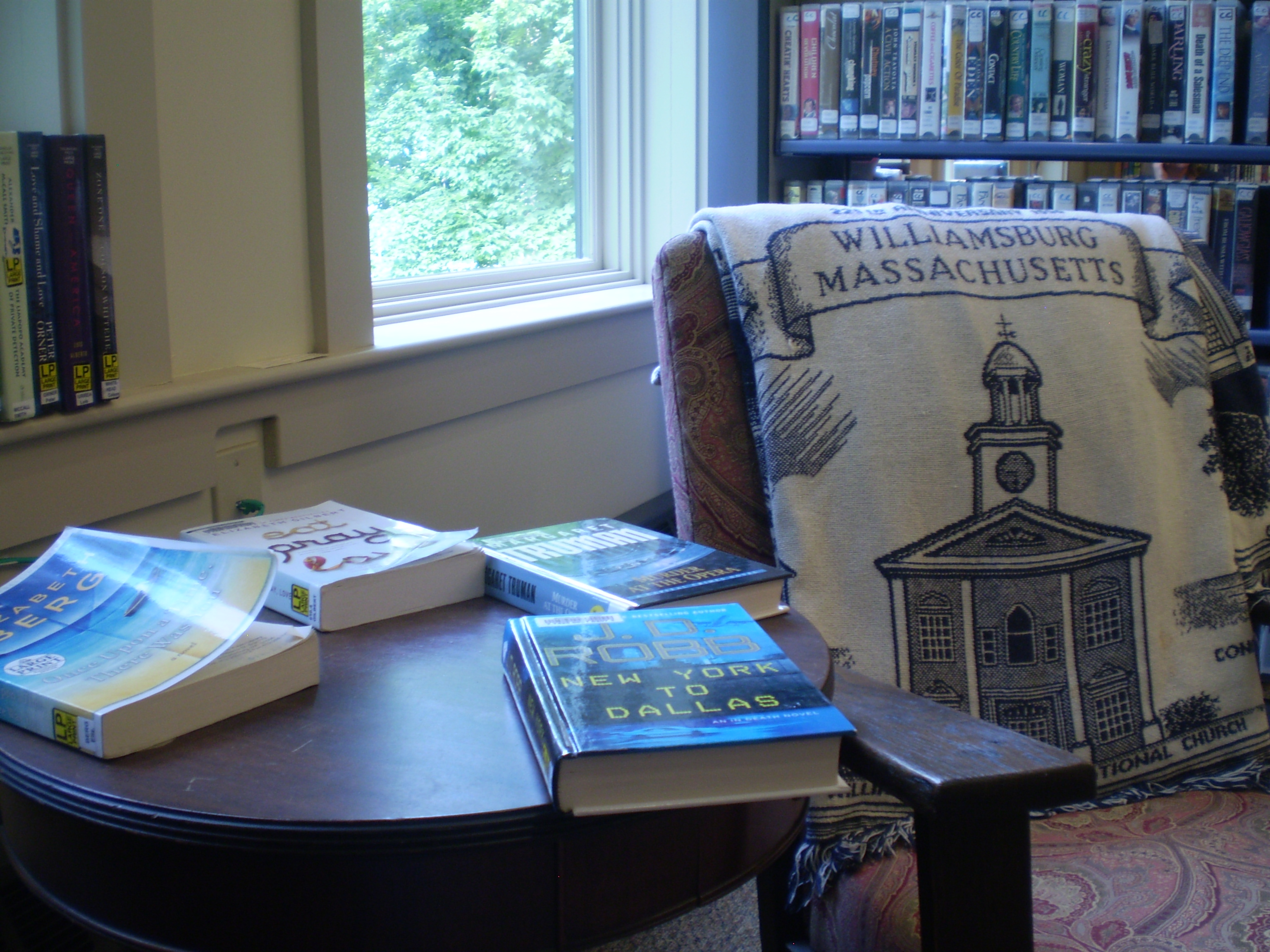
 We arrived in Williamsburg at 3:00. I read for awhile at the public library and then, at 4:00, I headed to the center of town for the return bus, which arrived a little after 4:15. The same driver was still working. Despite our initial confrontation, I liked him: he let me off wherever I wanted, both in Williamsburg and Northampton, and I admired his patience with a wheelchair-bound veteran when we stopped at the VA Hospital. I was back in Noho by 4:50 and home a little after 5:00.
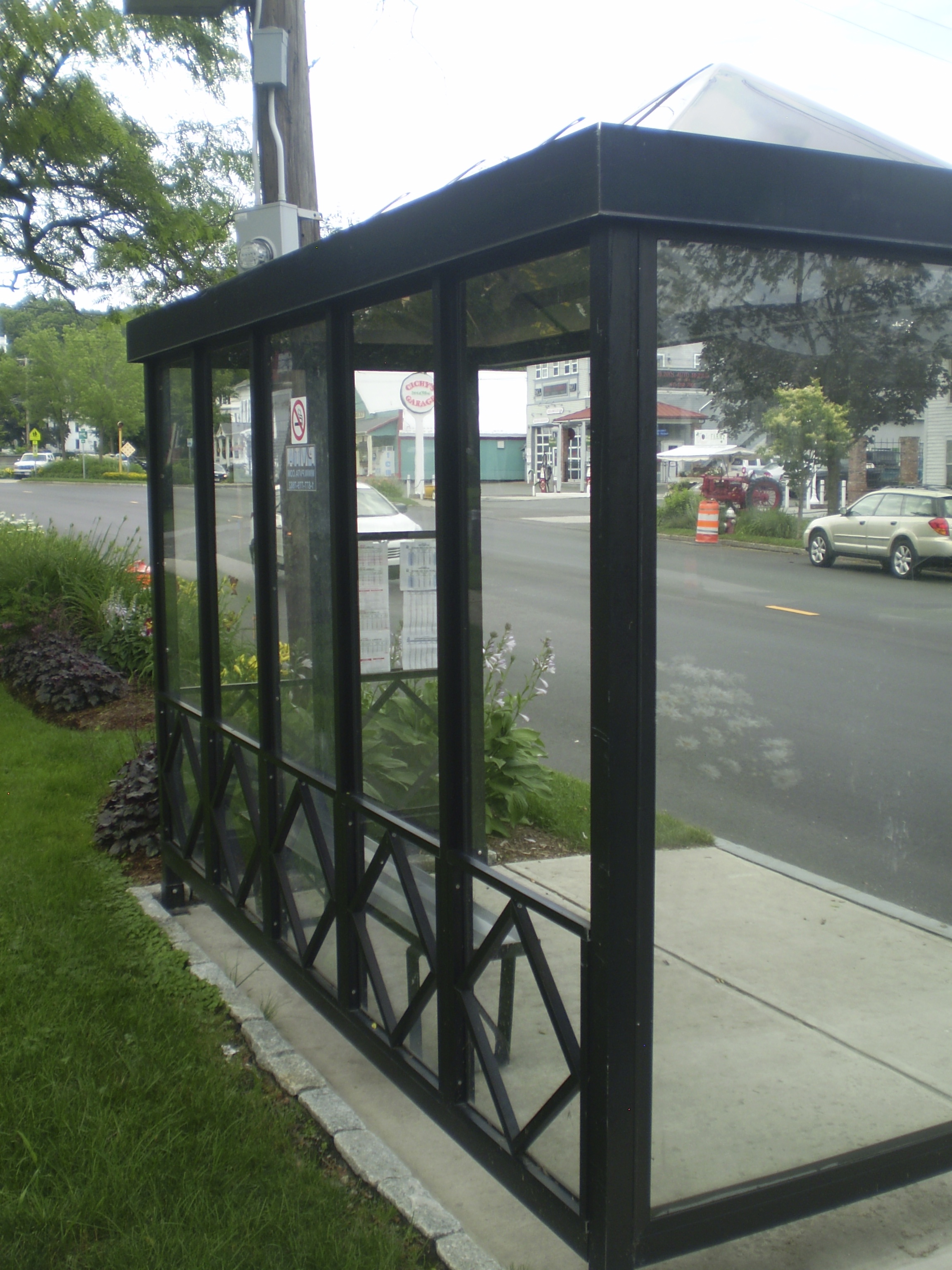
 This photo was taken from the bus stop in Williamsburg – you can see the inbound R42 letting off passengers across the street.
 July 3, 2013: Biking to Williamsburg

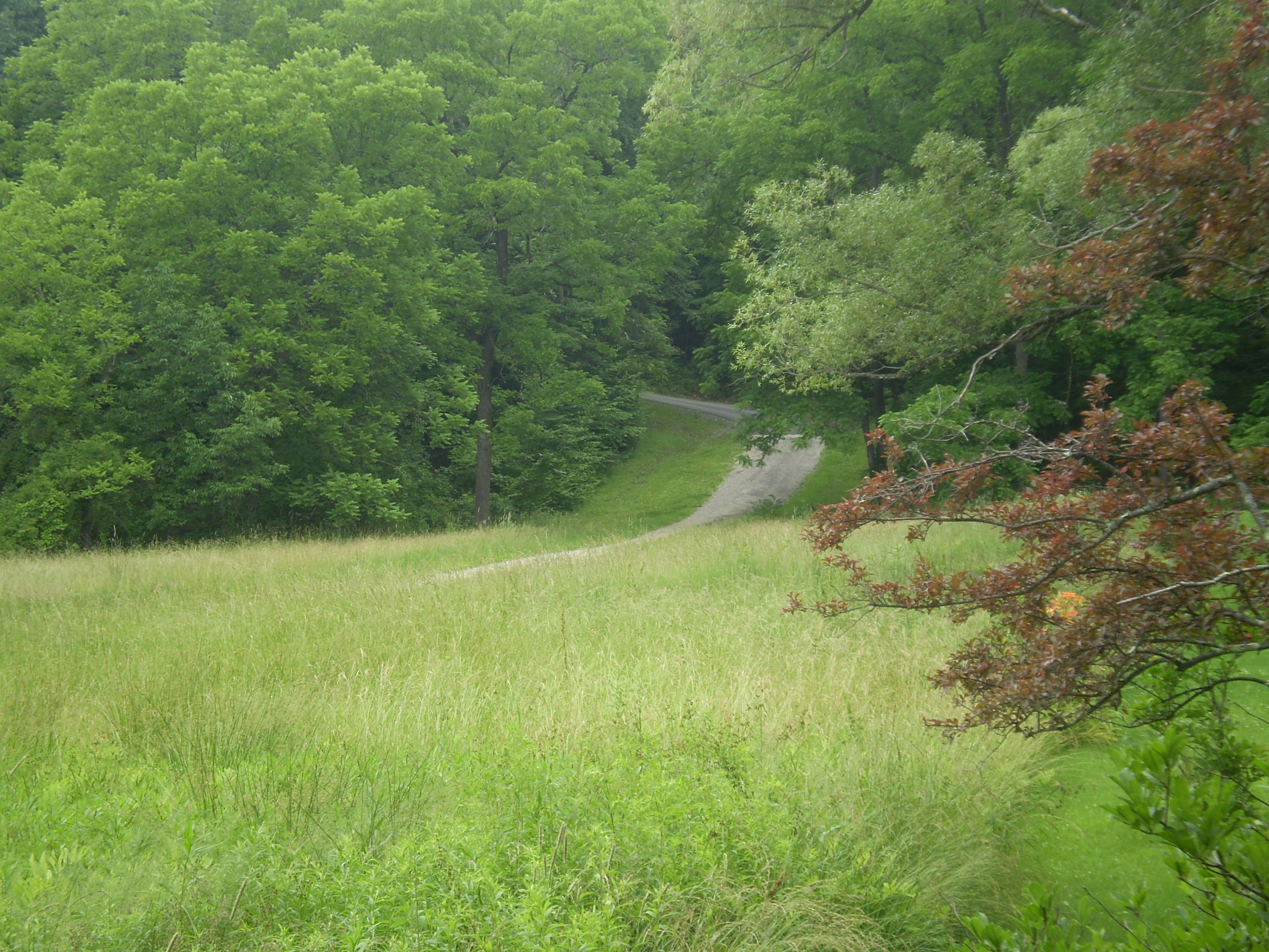
I confess to having biked from Northampton to Williamsburg before. After riding almost exclusively on the local rail trails for several years, I decided in the summer of 2012 to explore the country roads of the Pioneer Valley by bike. My first trip, in fact, was to Williamsburg, down the rail trail to Leeds, then up Audubon Road to South Street and into Williamsburg, an 18-mile journey round-trip. It was a revelation – not only because I was now riding for the first time in the hilltowns, a bit of a shock to my legs and lungs, but also because I was in some of the most beautiful farmland I had ever ridden in. I will never forgot it.
 During that summer, the bridge at the end of River Road was closed, so I never went that route, though I was always curious about it. For my 2013 Williamsburg experiment, I thought I’d try River Road, entering Williamsburg by Route 9. I would take South Street and Audubon Road on the return. Here’s that round trip, from Leeds to Williamsburg and back, a different way each leg.
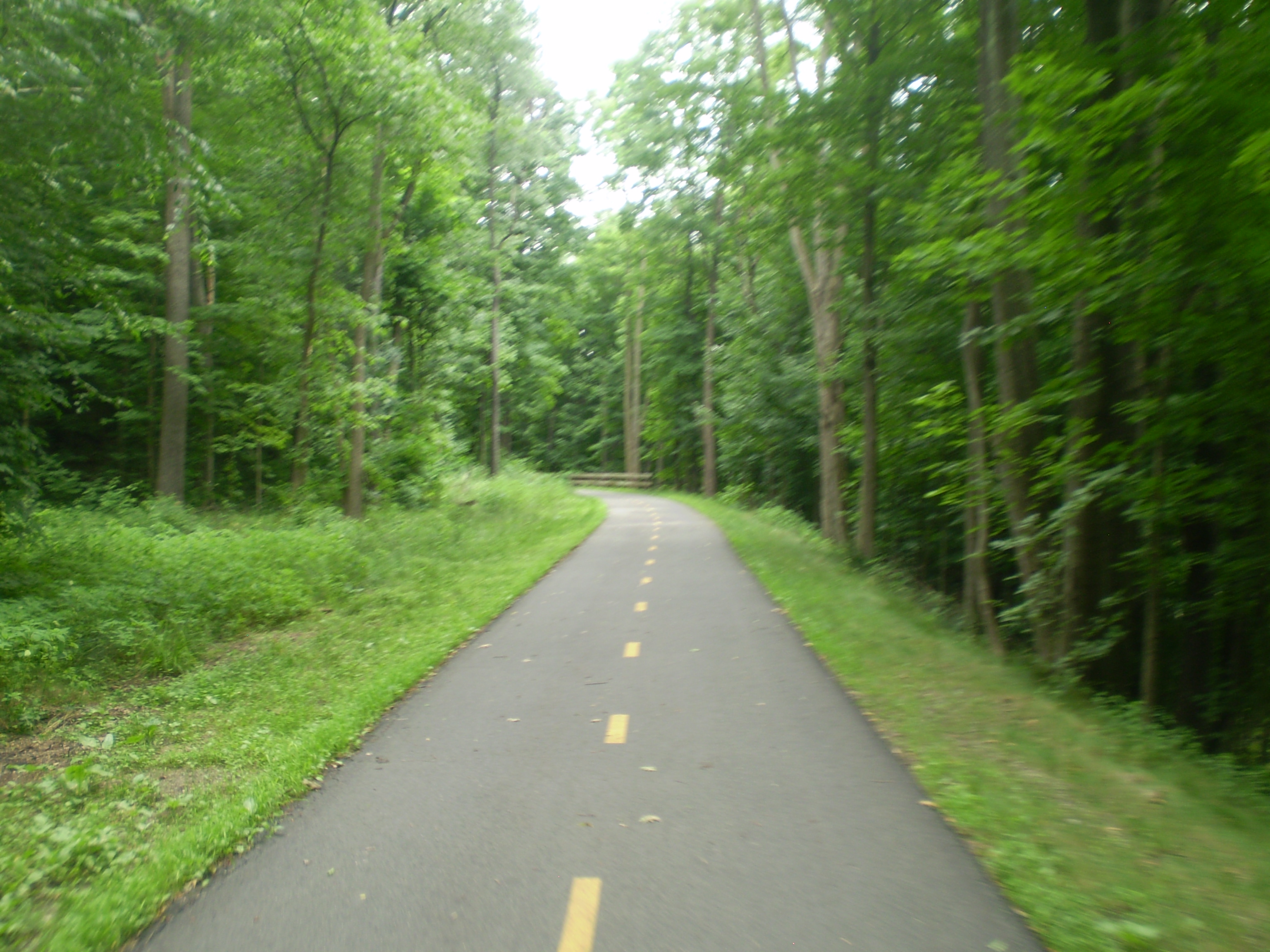
But of course I started the whole trip on the rail trail off King Street in Northampton, near my house.

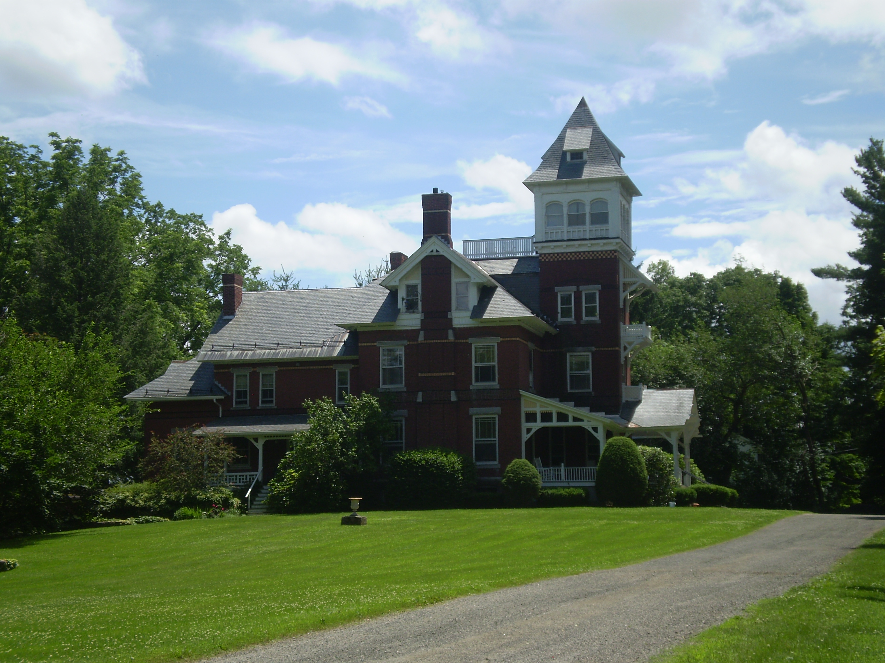
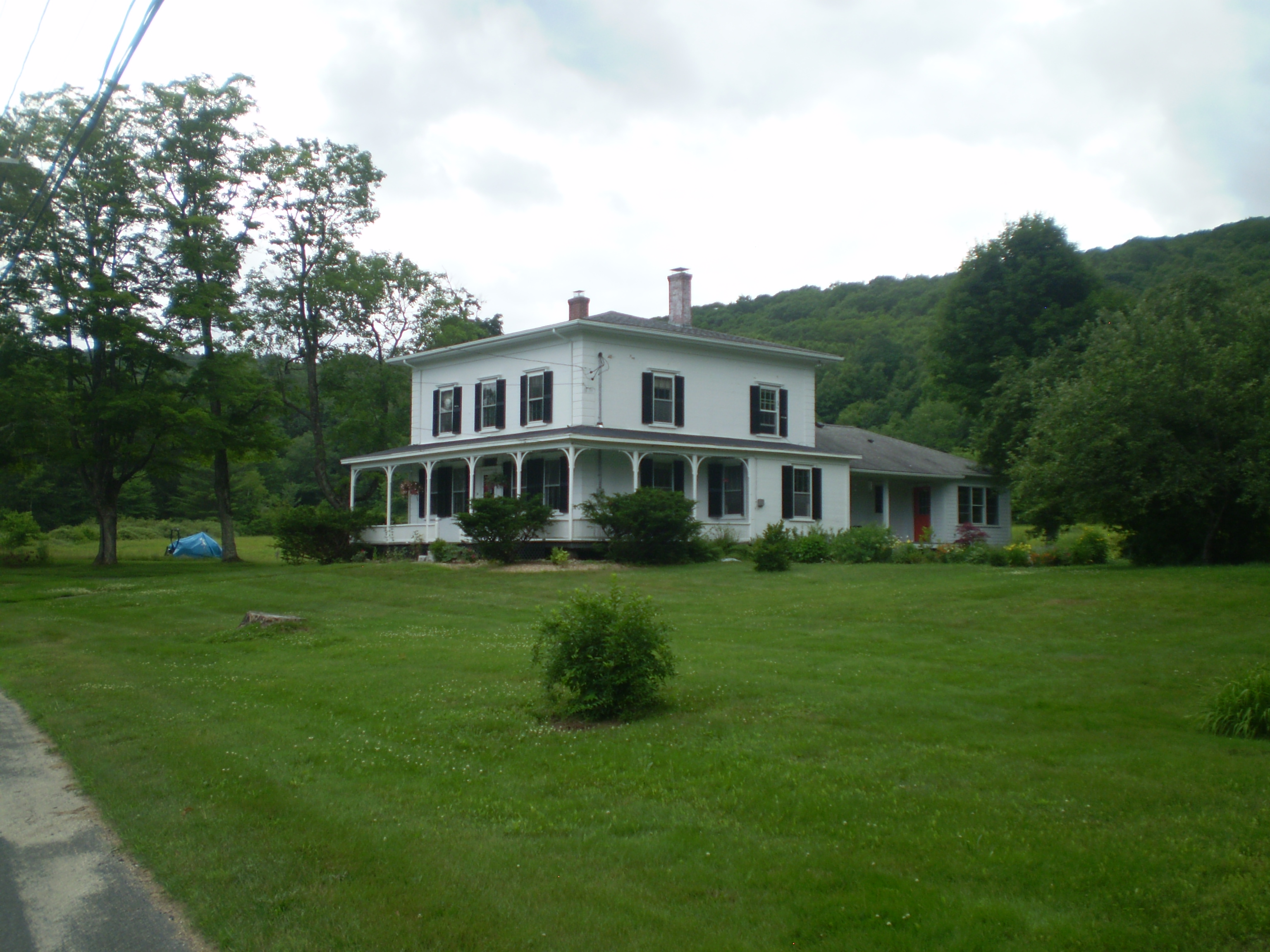
Once in Leeds, I took a detour up Grove Hill to see the Lucius Dimock mansion, which I had seen from the R42 bus the day before but wasn’t able to photograph. Dimock was the director of the Nonotuck Silk Mill, down the hill in Leeds, in the late nineteenth and early twentieth centuries. He’s buried in Bridge Street cemetery in Northampton, near my house. The mansion is now condominiums.
From the center of Leeds, I turned right on River Road.
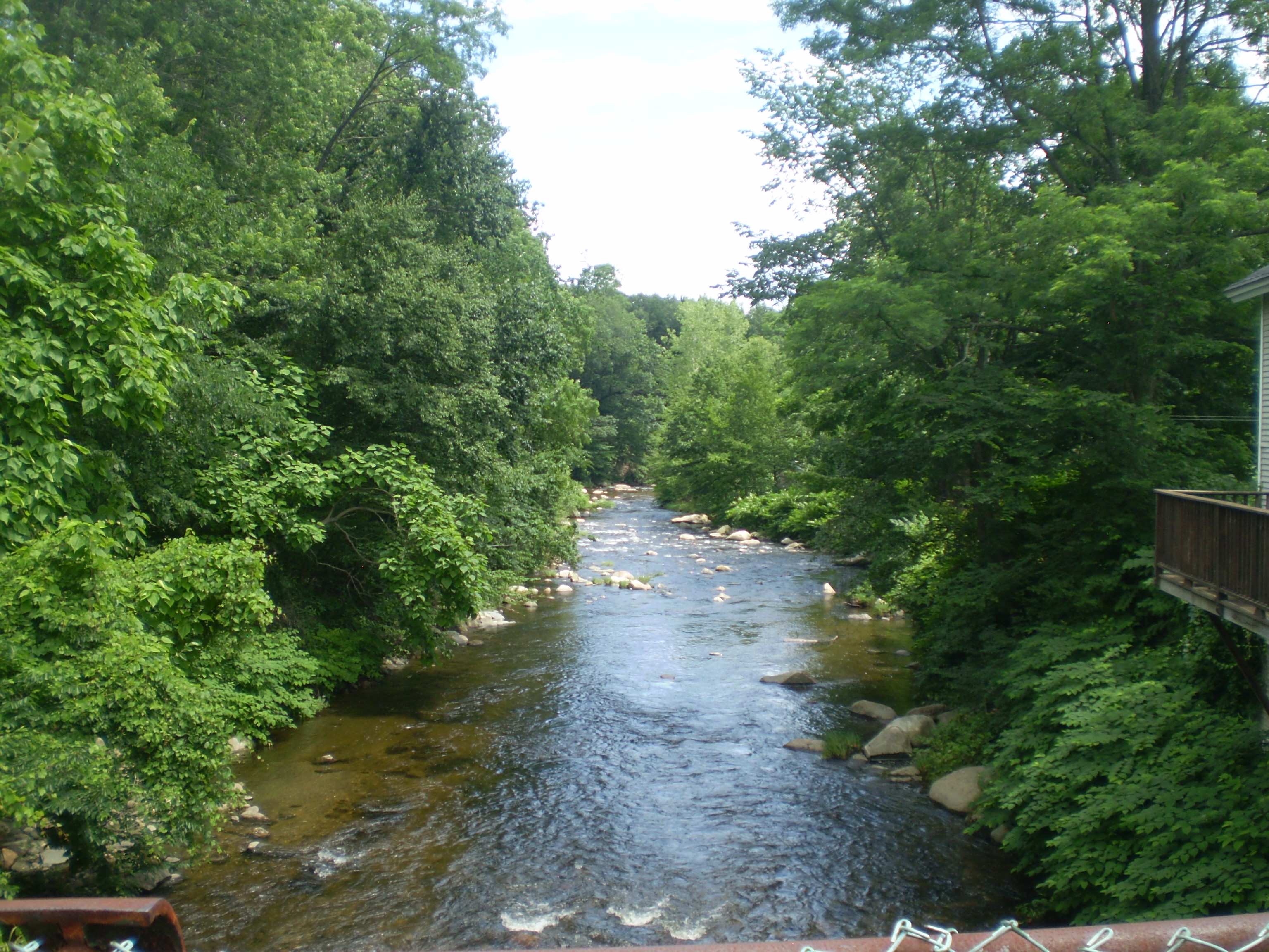
That took me into Haydenville,

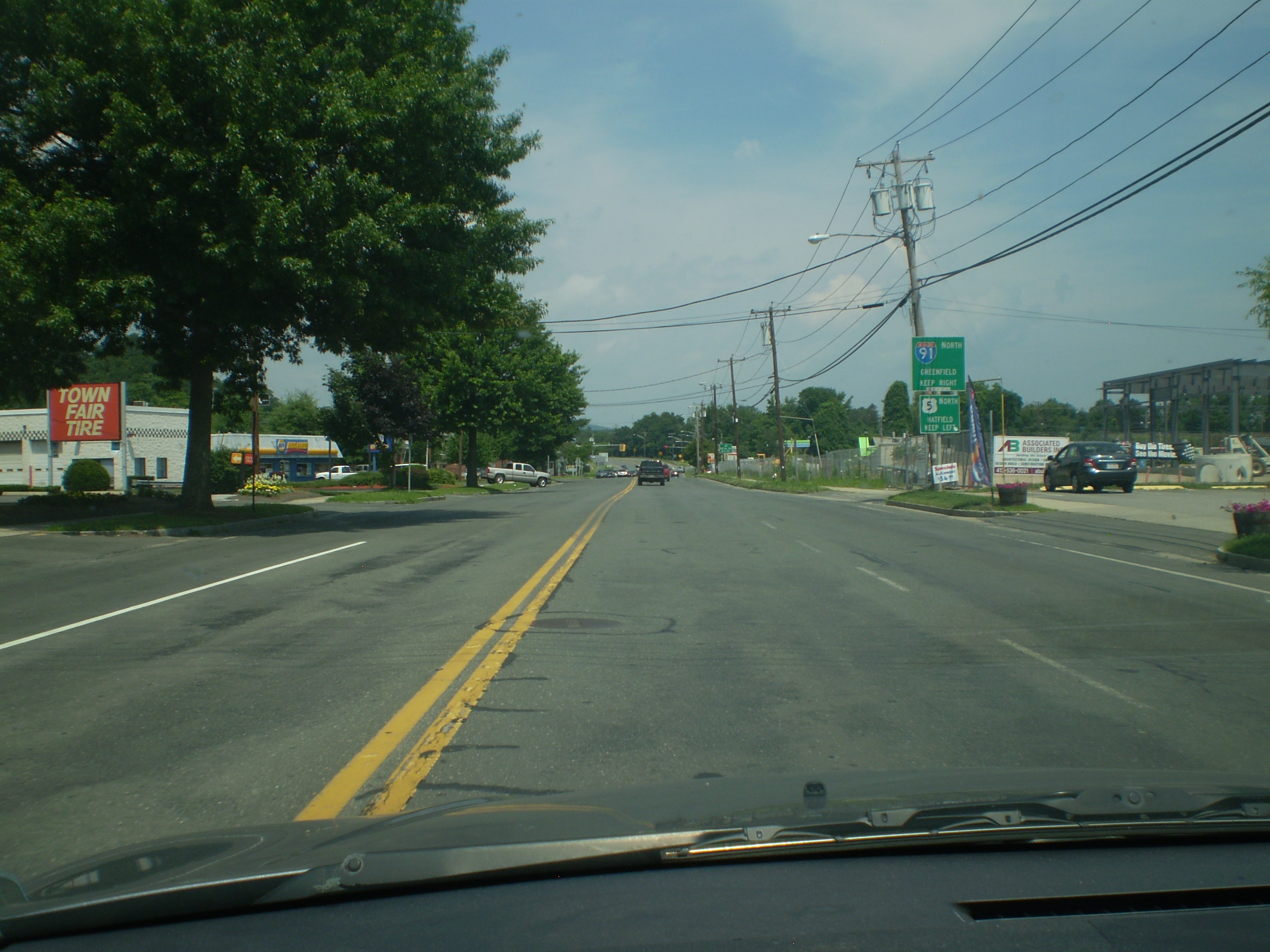
where I got onto Route 9:
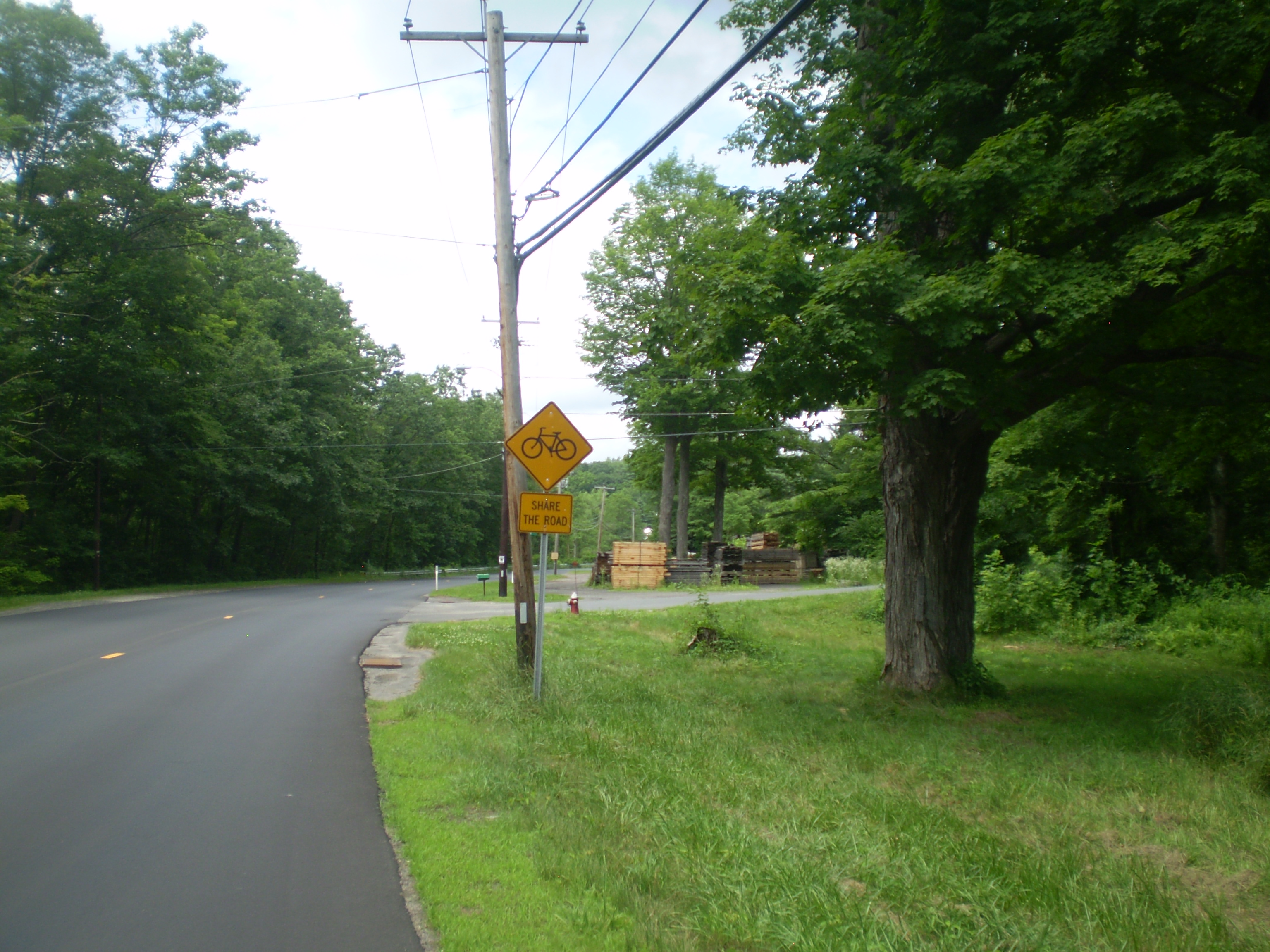
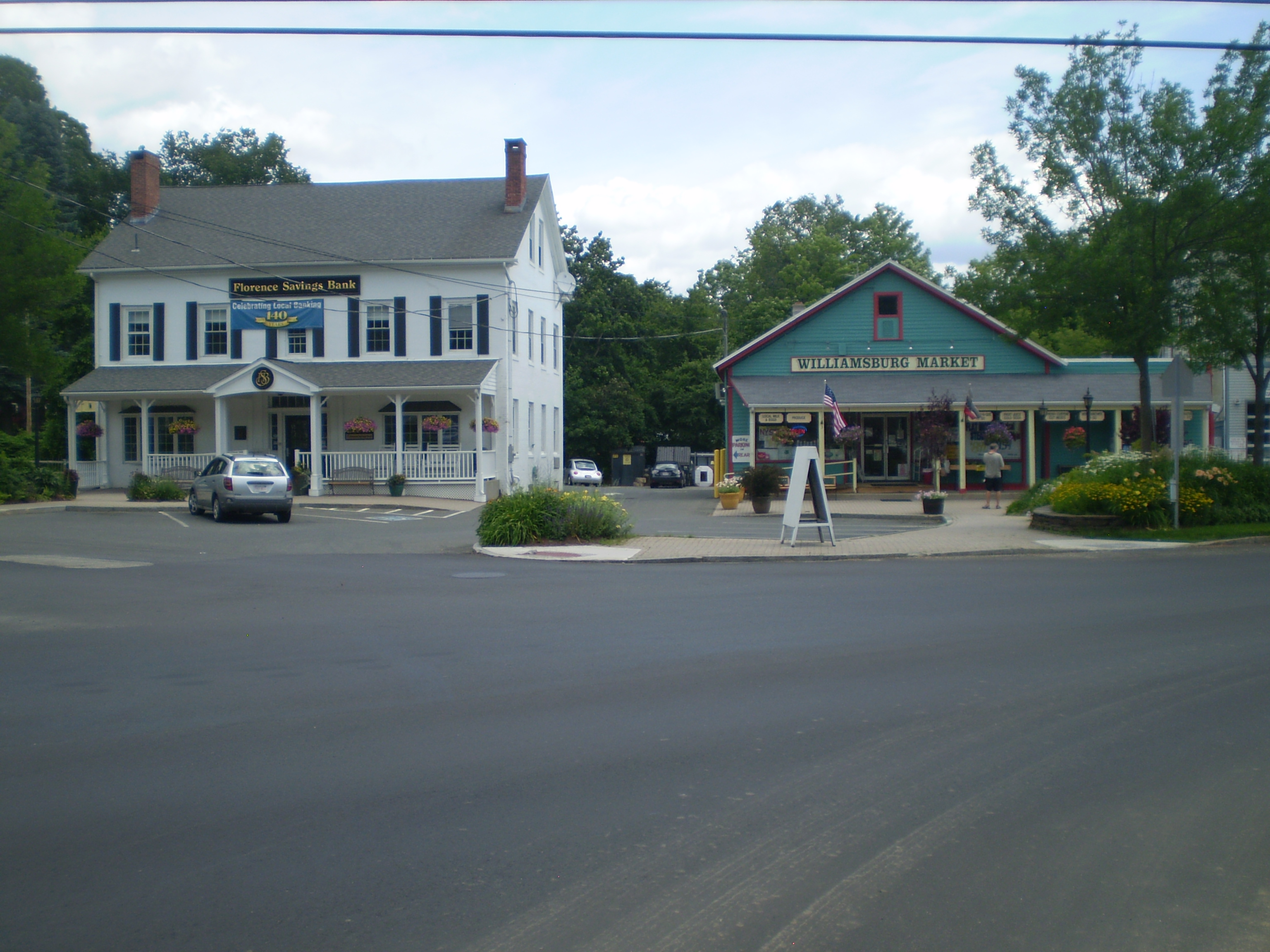
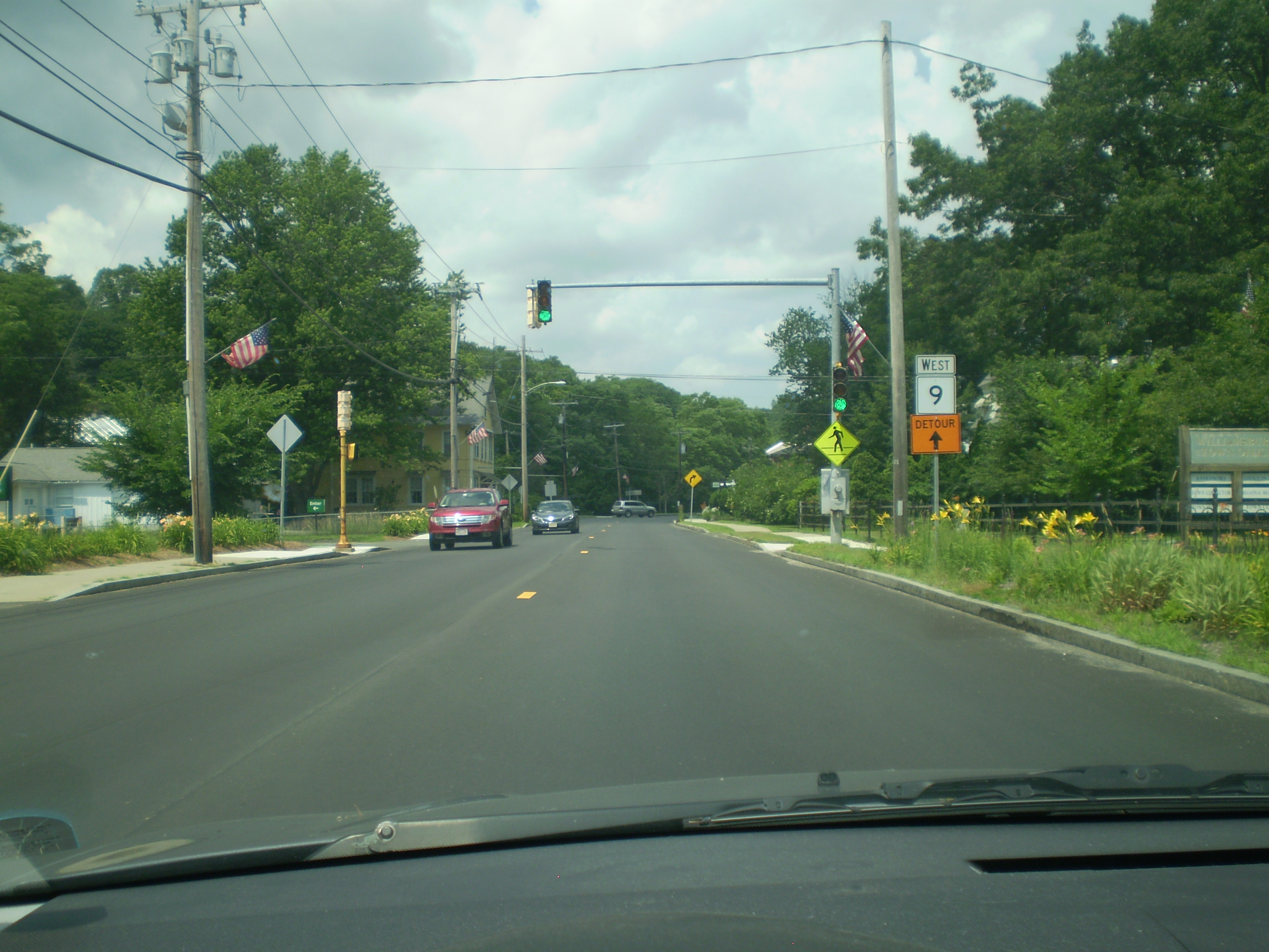
I counted three “share the road” signs on Route 9, but it was still not an ideal place for cycling – there was just too much traffic and no bike lane, not even a little strip on the side. Soon, though, I was in Williamsburg.

After stopping for awhile at the library, I headed back home via South Street.
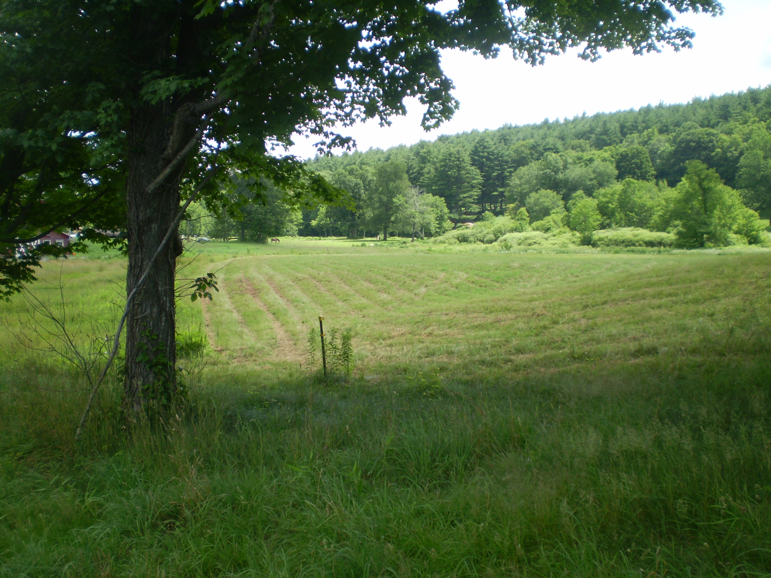
I rode through beautiful farmland:
Then, after traveling down Audubon Road into Leeds, I got back on the rail trail for the trip back to Northampton:
Total miles ridden: 18.3.
 July 6, 2013: On Foot to Williamsburg

The sun last Saturday was intense: we were in the midst of an awful heat wave. In fact, during my walk, a “Heat Advisory” was in effect from the National Weather Service. But I reasoned that if I left early in the morning, I’d be OK. And, frankly, since I don’t have air conditioning at home, I thought it couldn’t be worse outdoors than in. I left around 9:20 am, thinking I’d be home by 2 or 3 pm. It would be a 20-mile hike.
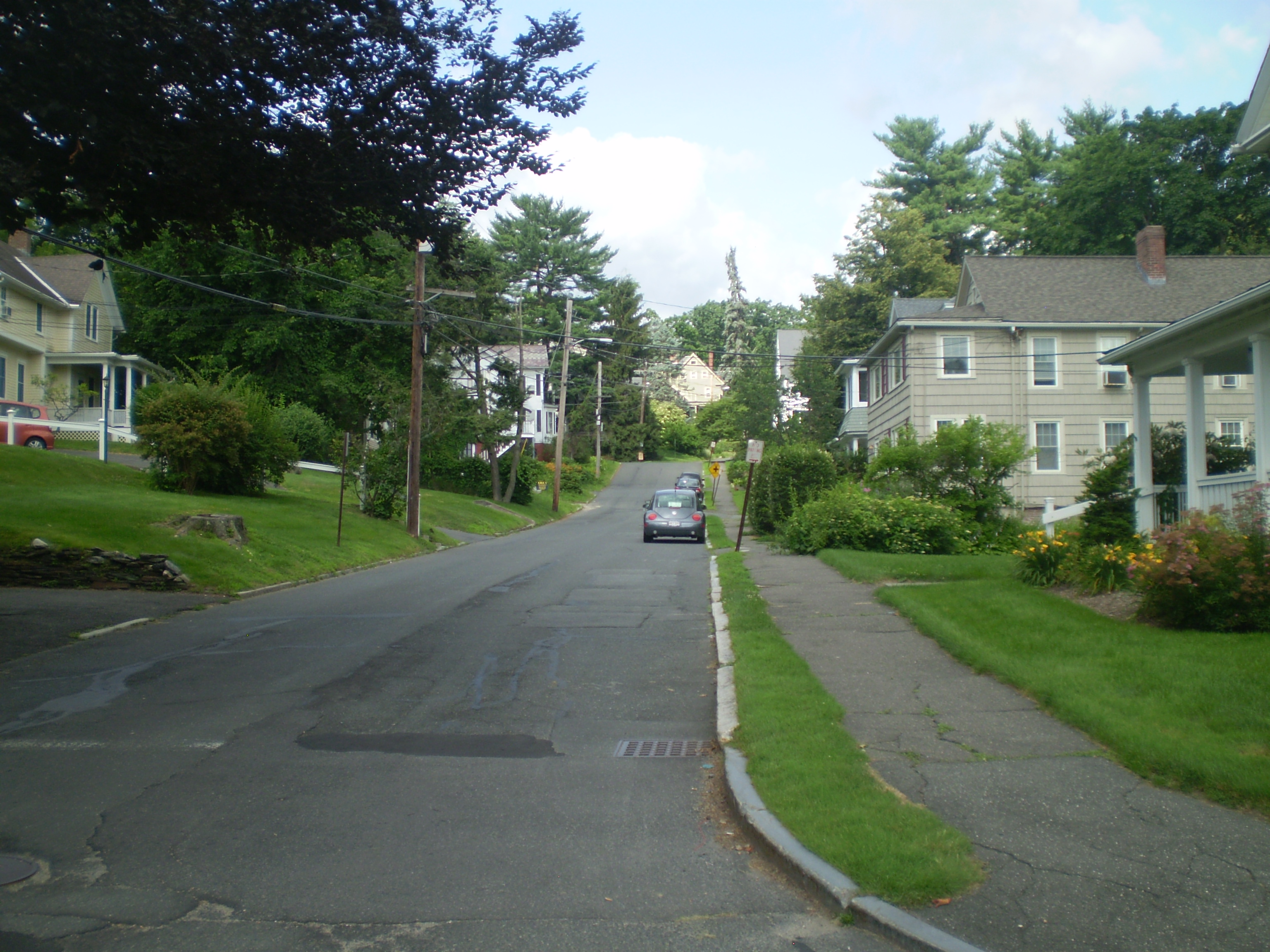
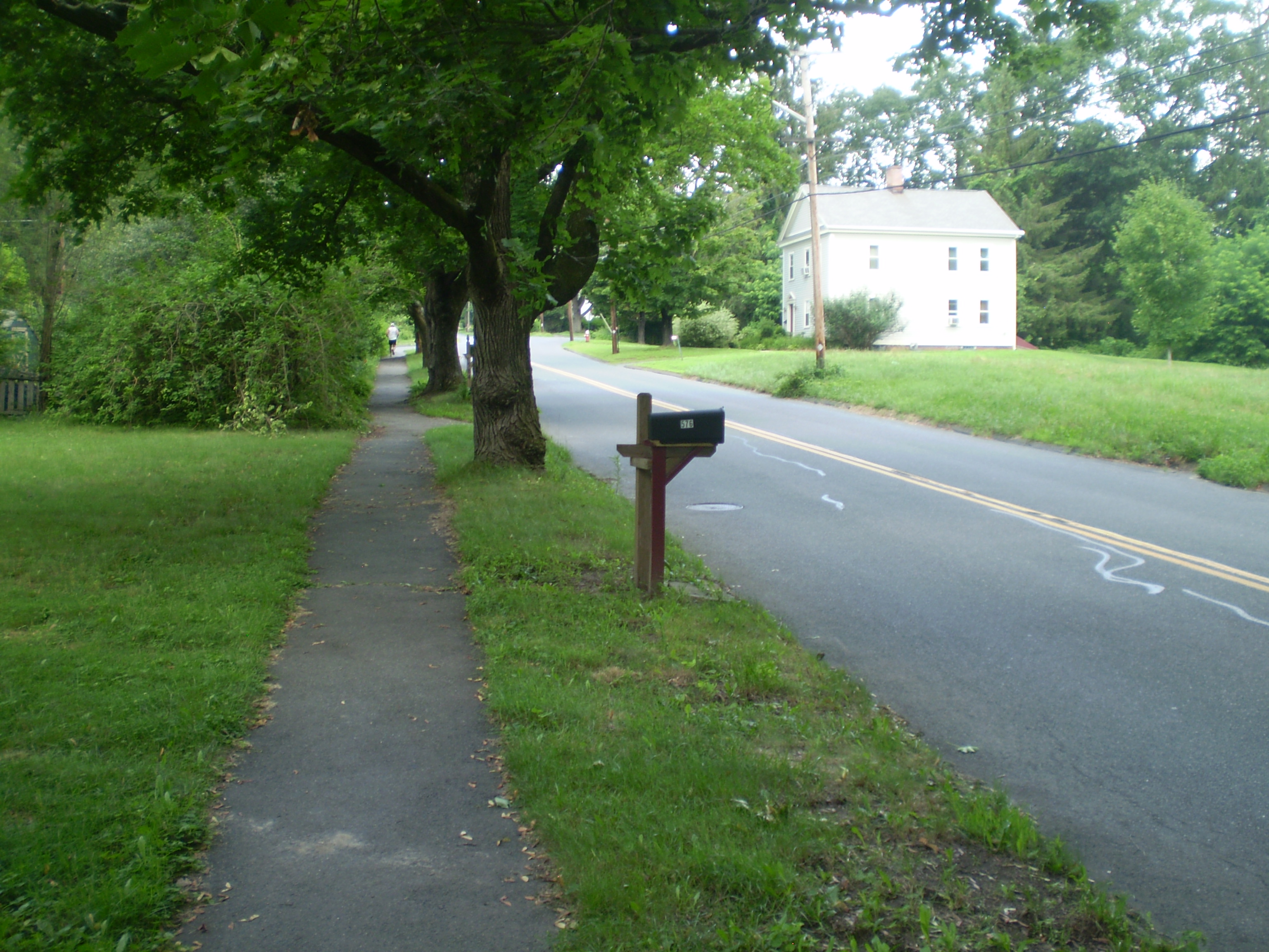
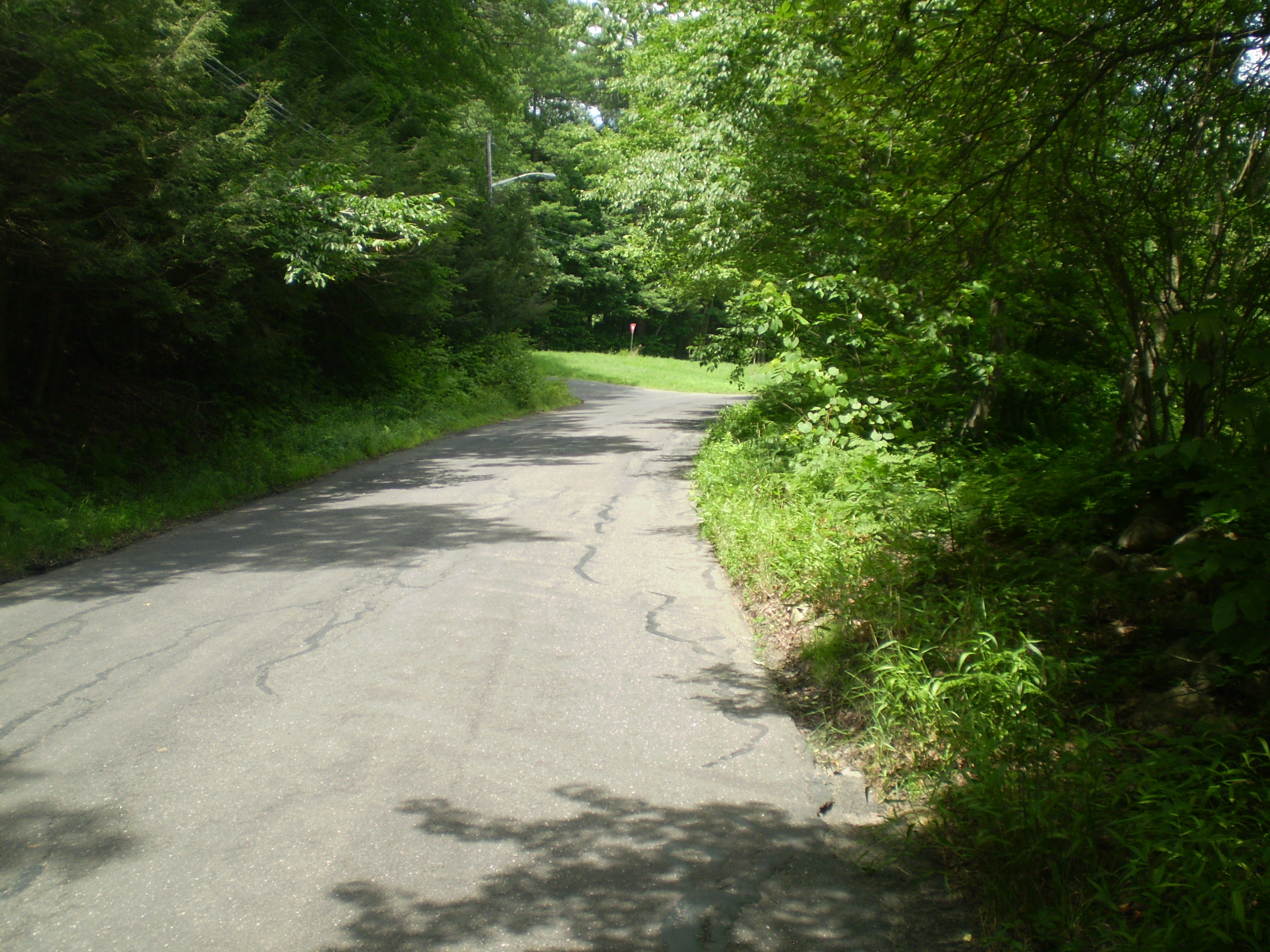
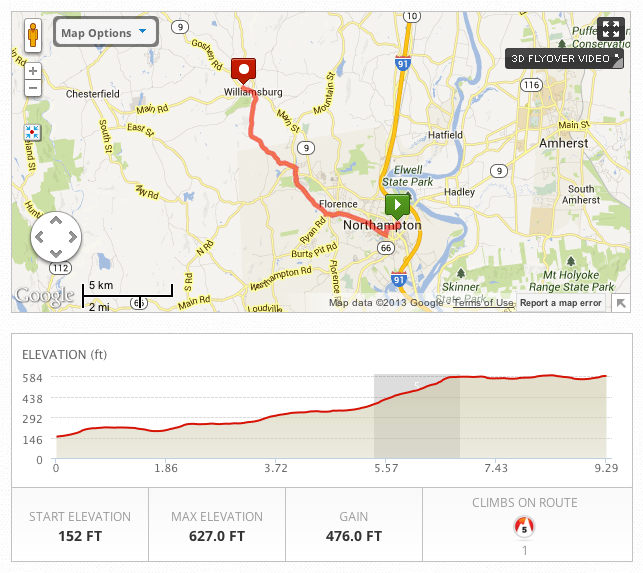
Since I had biked into Williamsburg, from Leeds, by River Road and Route 9, I thought I’d do the walk by way of Audubon Road and South Street, the same way I had biked home but now going in the opposite direction (that is, uphill). The question was, how would I get to Leeds on foot? Google would have me take either the bikeway or Locust Street into Florence and then get on Route 9 there. I didn’t relish the idea of walking along either Locust Street or Route 9 during a heat wave: there were too many cars and too few trees. From the map, I realized I could head up tree-lined Elm Street by Smith College, then drop back behind Northampton High School into Bay State Village, and then take Spring Street through the Florence countryside into Leeds, arriving at Audubon Road right below the bikeway. There would be fewer cars and more shade. And, best of all, I would get to see the Northampton Community Farm, which I had never visited. Here’s the route from my home on Highland Avenue to Leeds:
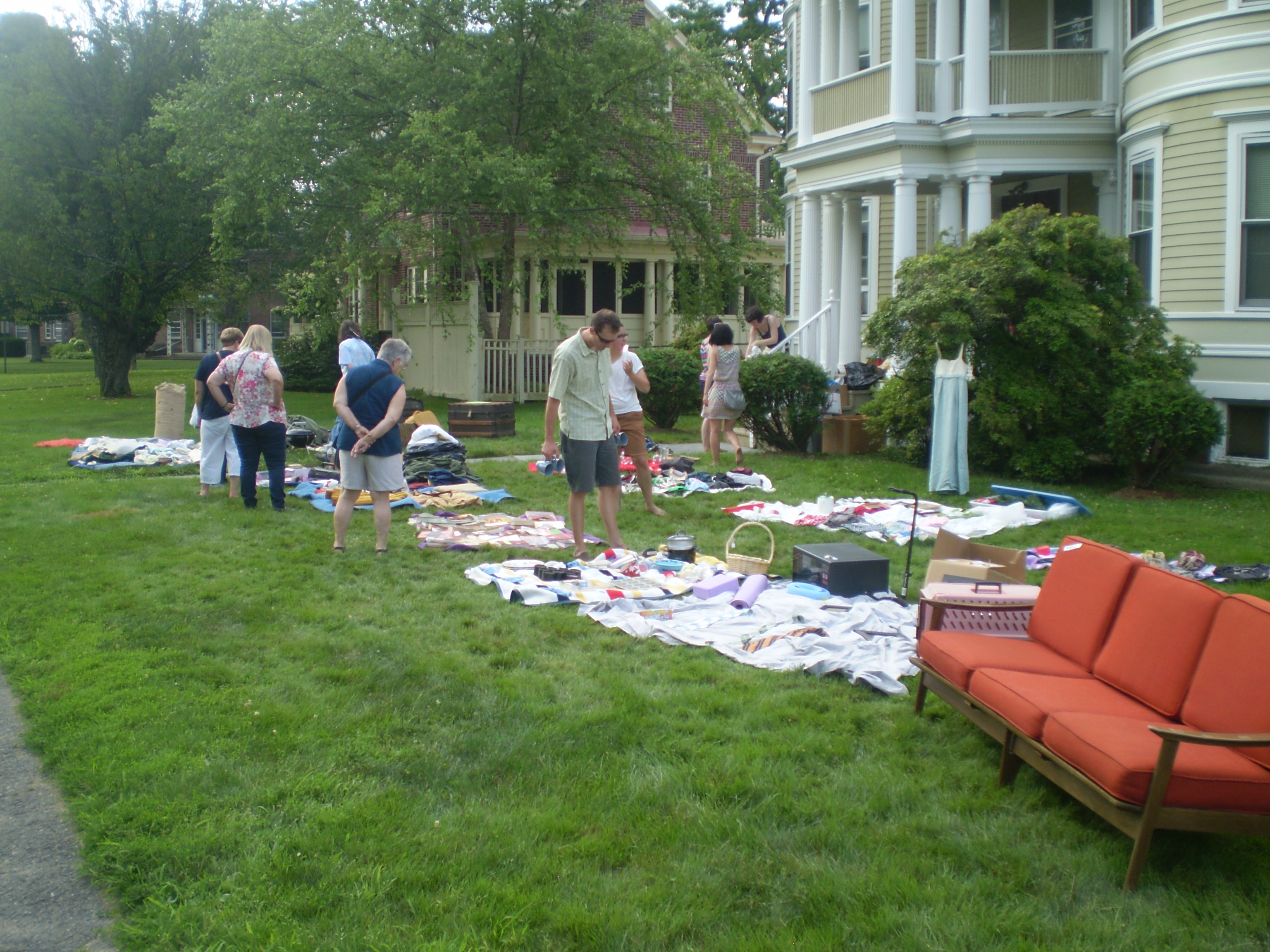
As soon as I stepped outside, I knew it was going to be hot. But I was surprised at how tired I felt after walking just a few blocks. I had sweated through my shirt by the time I got to Smith College. Other people were out, though – there was even a tag sale on Elm Street, near the high school. Once on Nonotuck Street, it felt like I was in the country.

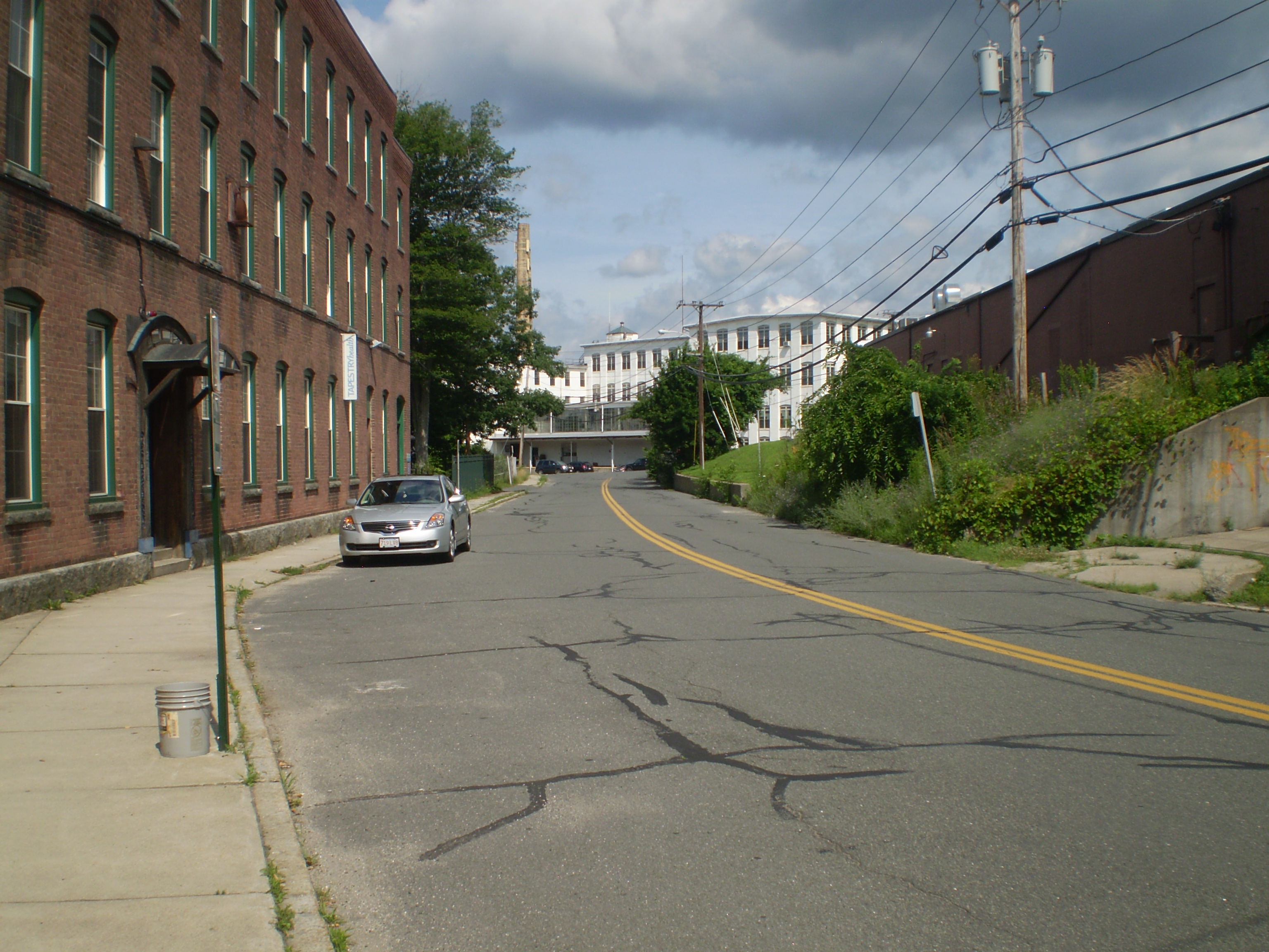
Near the Mill River, the landscape became suddenly industrial, almost derelict:
But on Spring Street, in Florence, I was back in a rural landscape, soon passing the Northampton Community Farm:
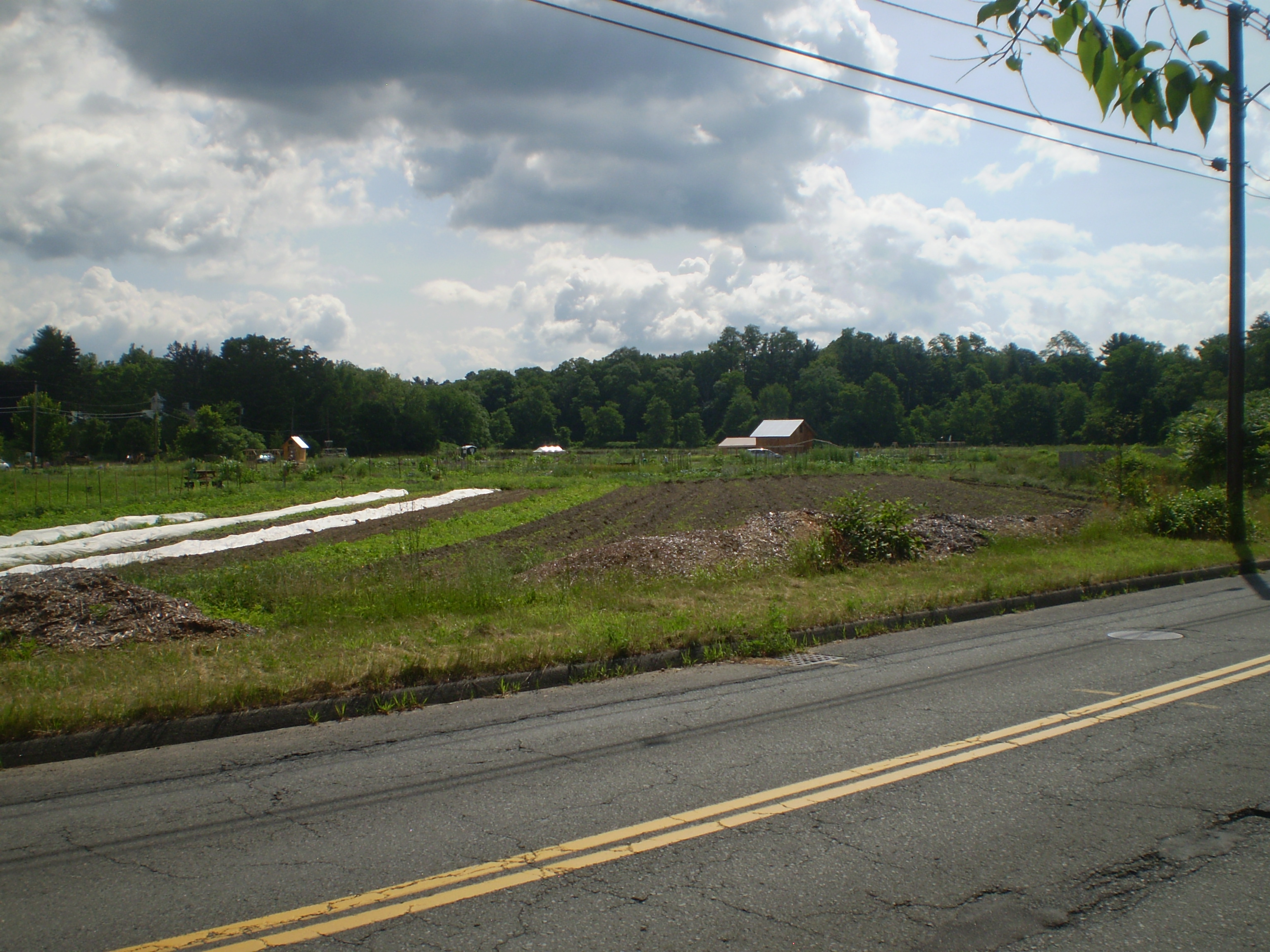
And the associated Crimson and Clover CSA Farm:

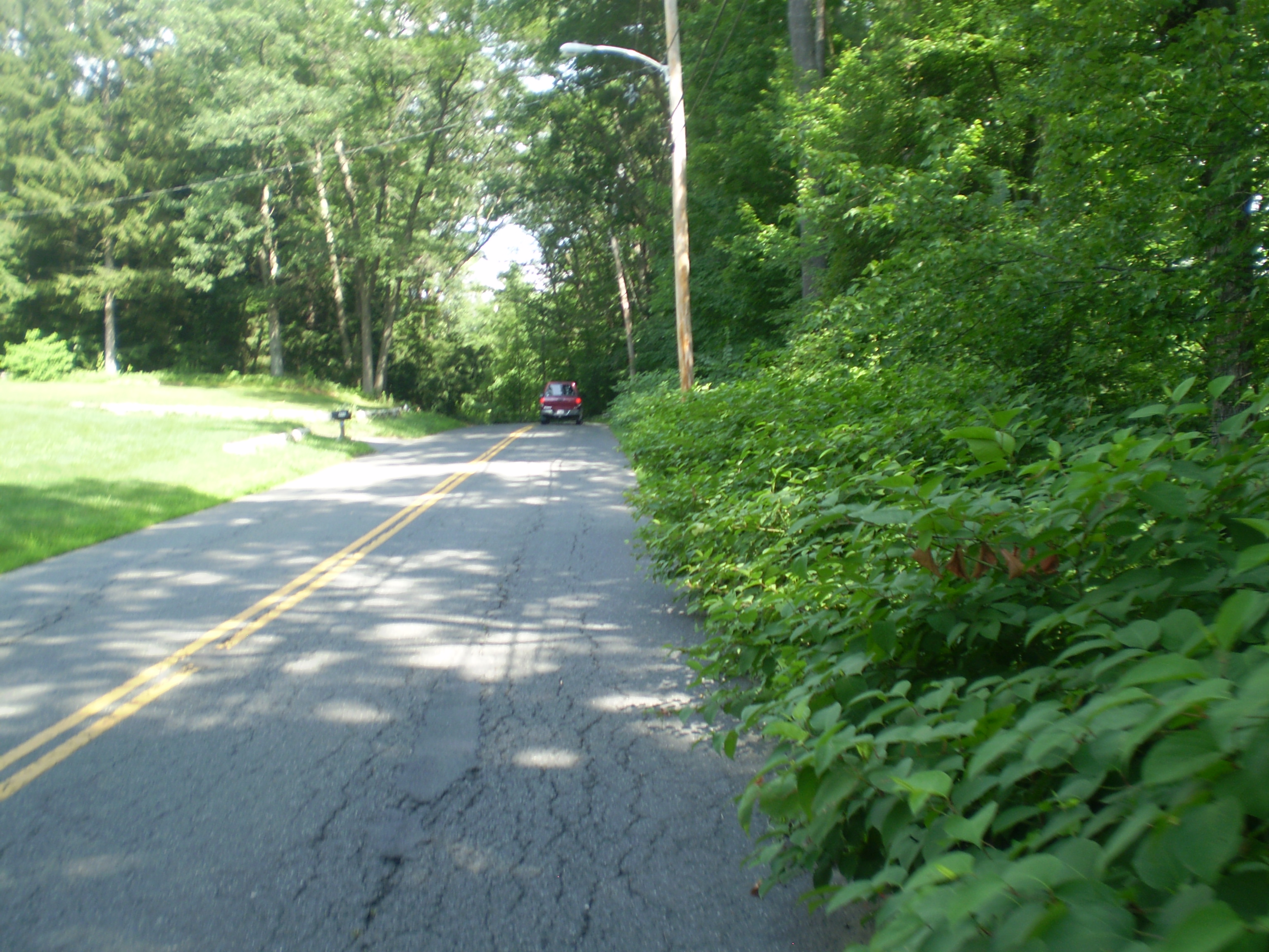
Near Leeds, the terrain got hillier, denser:
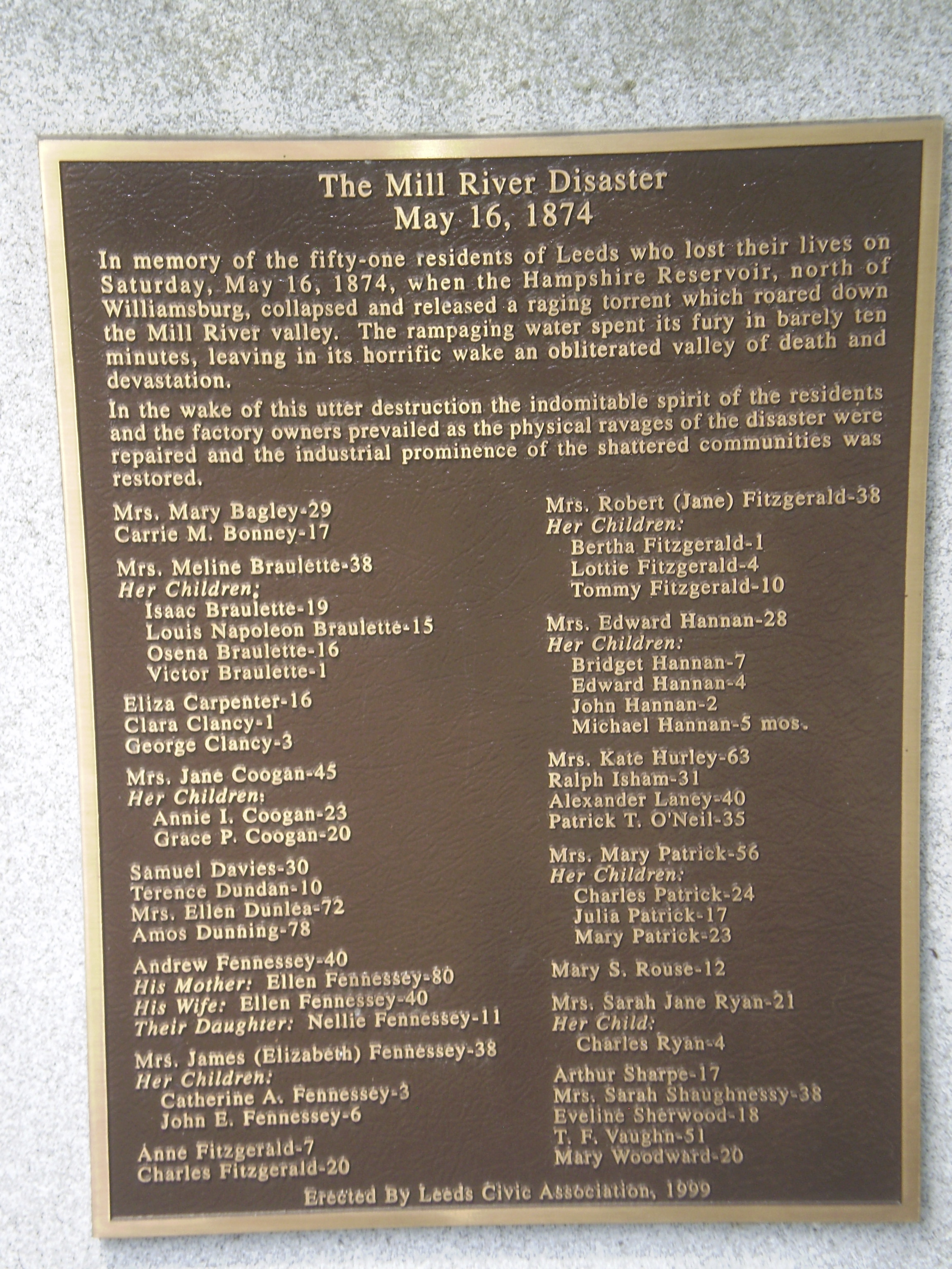 In Leeds itself, I stopped to read a plaque memorializing the victims of the Mill River flood, which, according to Elizabeth M. Sharpe, was one of the greatest calamities of the nineteenth century: “It happened early one May morning in 1874, in the hills above the western Massachusetts towns of Williamsburg and Northampton, when a reservoir dam (used for waterpower) suddenly burst, sending an avalanche of water down a narrow valley lined with factories and farms. Within an hour, 139 people were dead, and four mill villages were washed away.” The flood haunted my trips to Williamsburg – I not only walked or rode by the Mill River for much of the project, but I kept coming across signs of the disaster. There’s another plaque memorializing victims in Williamsburg, and parts of the river valley, Leeds and Haydenville in particular, seem eerily quiet, almost abandoned, as if still traumatized by the past. Sharpe argues, in fact, that the Mill River valley never fully recovered from that flood.
Right after I passed the memorial plaque in Leeds, I came upon the old Nonotuck Silk Mill, which Lucius Dimock ran and which resembles his mansion. It survived the flood, but it also seems vaguely haunted by the past. It’s now an apartment complex.

From Leeds center, I headed up steep Audubon Road towards Williamsburg. I was now in the country. It was 11:00 am: I had been walking for more than an hour and a half in intense heat. I was hot, tired, sweaty, hungry, and thirsty.
I stopped for lunch along a low rock wall, shaded by trees.
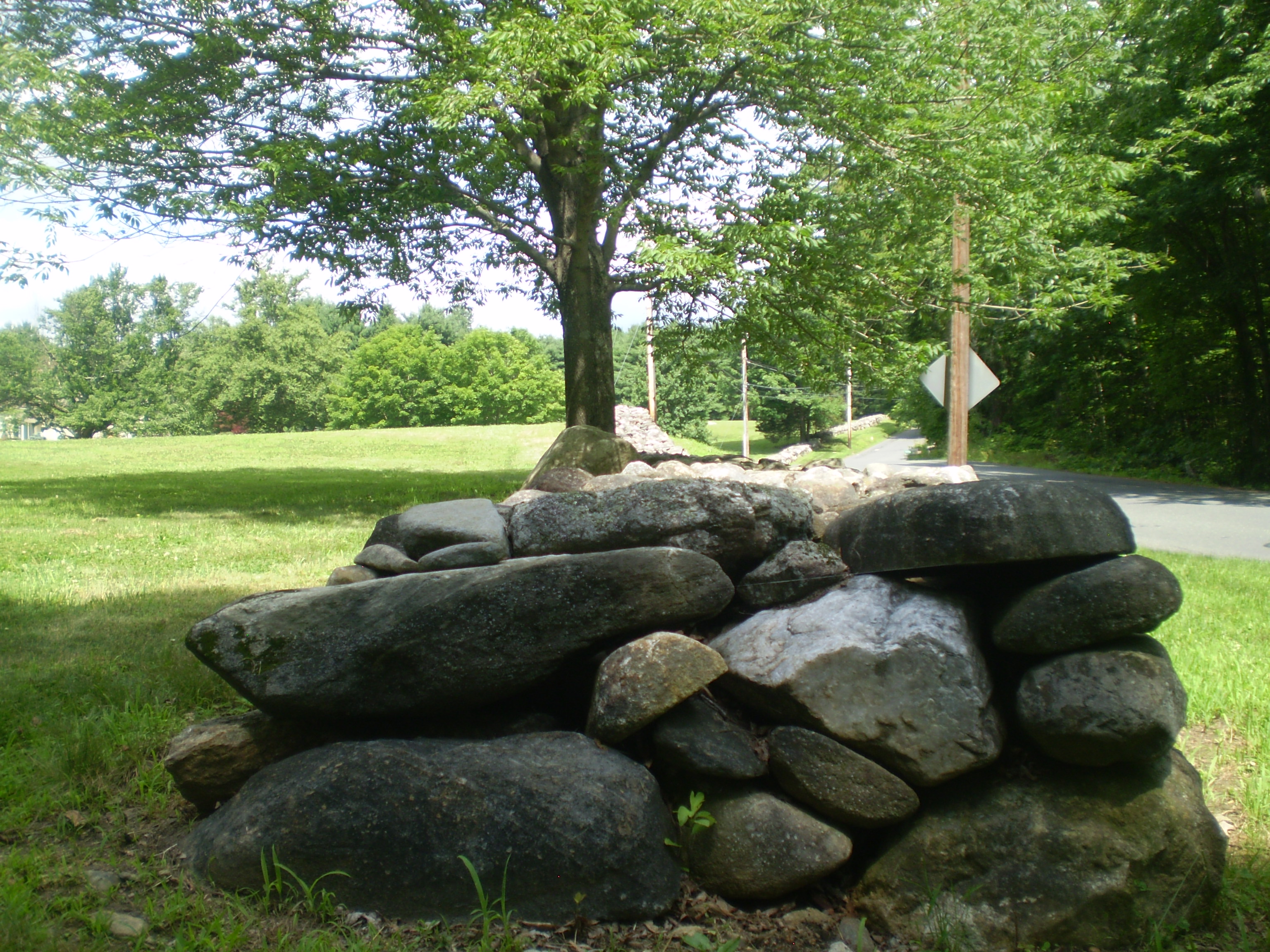
It was then that I began to formulate an alternative plan. I would finish the inbound hike into Williamsburg but then take the R42 bus back to Northampton. I would have to get cash for the fare, then get change from a store, and hope that I wouldn’t have to wait too long for a bus. But the hassles seemed worth it – the thought of doing the return trip on foot, in the middle of the afternoon, during a heat wave, was unpleasant. Fortunately, the combination of lunch, a bit of rest, and the image of an air-conditioned bus invigorated me, and I pushed on up Audubon Road to South Street and into Williamsburg. I was there by noon.
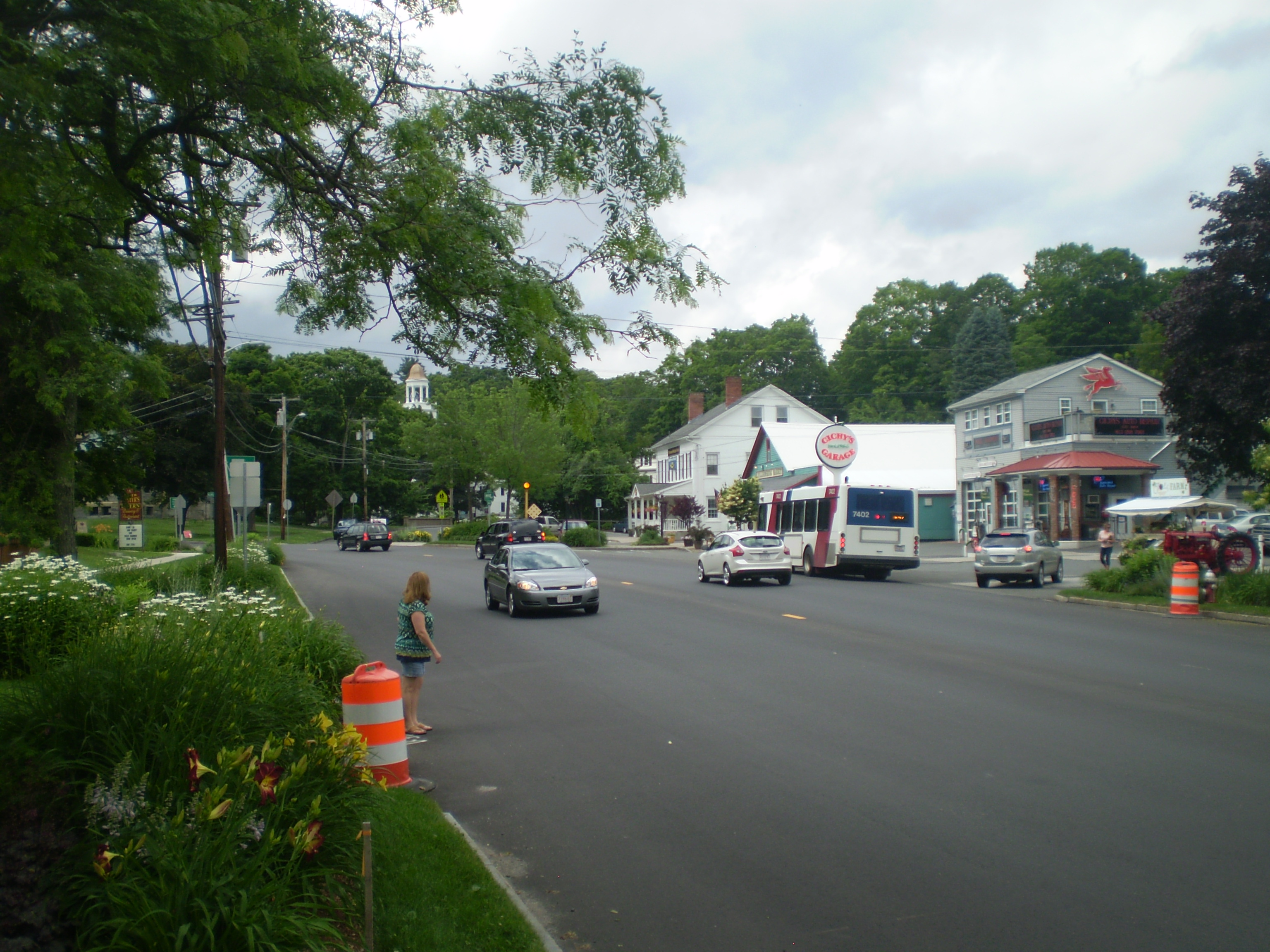
Once in town, I got cash, bought a bottle of cold lemonade, and was sitting by the bus stop when the R42 pulled up at 12:30 pm. I was back in Northampton by 1:00 pm and taking a cool shower a half hour after that.


Here’s the first leg of my trip, a 10-mile hike, much of it uphill in intense heat, as represented by MapMyWalk:
Of the four trips I took to Williamsburg (the driving portion is recounted below), the walk was the most memorable. I’m sure I was miserable – I don’t think I’ve ever been hotter or sweated more – and yet it seems in retrospect to have been an extraordinary event. For a few hours that morning, I lived a life very different from my usual life. I can see even now the blazing sun, the empty road, the narrow, fast-moving river, and the steady propulsion of my legs as I walked through a rural summer landscape. And yet I also vividly recall: when I walked into that store in Williamsburg for a bottle of lemonade, the other customers eyed me warily. I must have looked like a vagrant, traipsing wearily into their midst.
 July 7, 2013: Driving Route 9 to Williamsburg

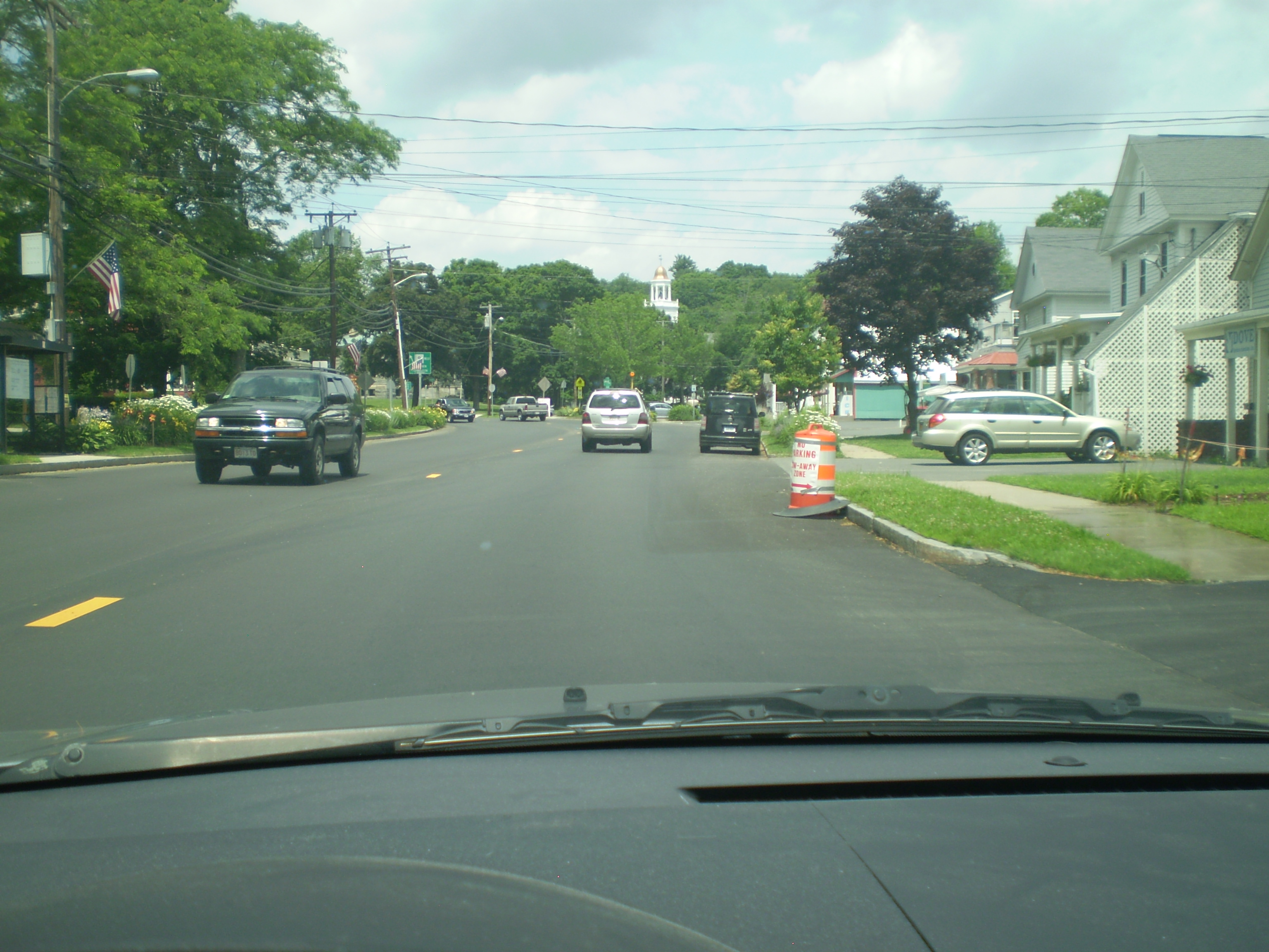
My last trip was by car. It was the shortest, the least edifying, and the dullest part of this project. That’s not to say I don’t appreciate the benefits of having a car. It’s the only way, for example, I could have gotten safely and conveniently to Williamsburg at night. Or in inclement weather. Still, the journey by car didn’t feel like a journey at all. I had to keep my eyes straight ahead. And I had to maintain a certain, rather fast, speed the whole time. Consequently, I saw little and learned less.
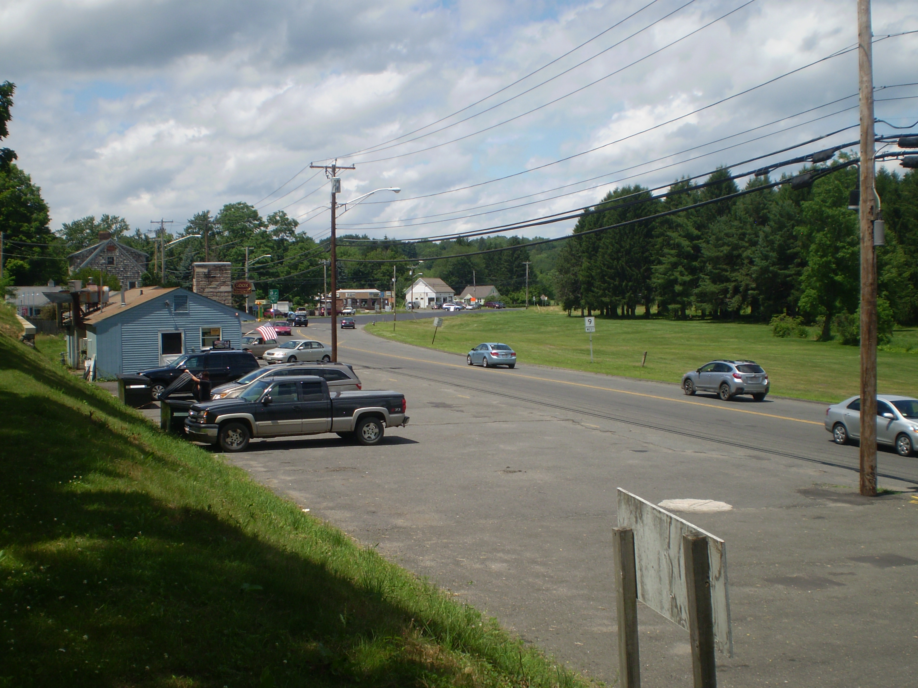
What the car does well, of course, is transform you into a shopper. As soon as I got behind the wheel, I was a potential consumer. And, in fact, Route 9 between Northampton and Williamsburg is lined with stores of one kind or another – fruit stands, gas stations, lumber yards, diners. It sometimes looks to me as if it were frozen in the 1950s:
And, truth be told, on the drive to Williamsburg, I stopped to buy a baguette at Bread Euphoria.
Other than that, the trip was dull and gray:
Fortunately, it was over quickly.
And so was my experiment in multi-modal travel.
By the evening of July 7, after a week of planning and execution, I had made four trips to Williamsburg, each one using a different mode of transportation. I had begun with Google Maps but ranged widely thereafter, both digitally and in reality. I travelled as much in time as in space. And I moved through very different landscapes: urban, rural, and suburban. I saw things I’d never seen before.
But in the end, I was left with a simple question to which I could offer only a complex (non) answer:
How do you get from Northampton to Williamsburg?
It turns out that there are many ways.
For the New York Times article on America’s declining car culture, click here.
For the APTA’s statistics on surging public transit, click here.
For Amtrak’s increased ridership, click here.
For the theory that young Americans want to stay wired while traveling, click here.
For one million unique monthly users of Google Maps, click here.
For the history of Google Maps, click here.
For Michael Schade’s Side-by-Side Router, click here.
For the PVTA as the second-largest free-fare public transit system in the world, click here.
For Northampton’s rail trails and bikeways, click here.
For Lucius Dimock’s Grove Hill mansion in Leeds, Massachusetts, click here.
For the Mill River disaster of 1874, click here.
For the Northampton Community Farm, click here.
